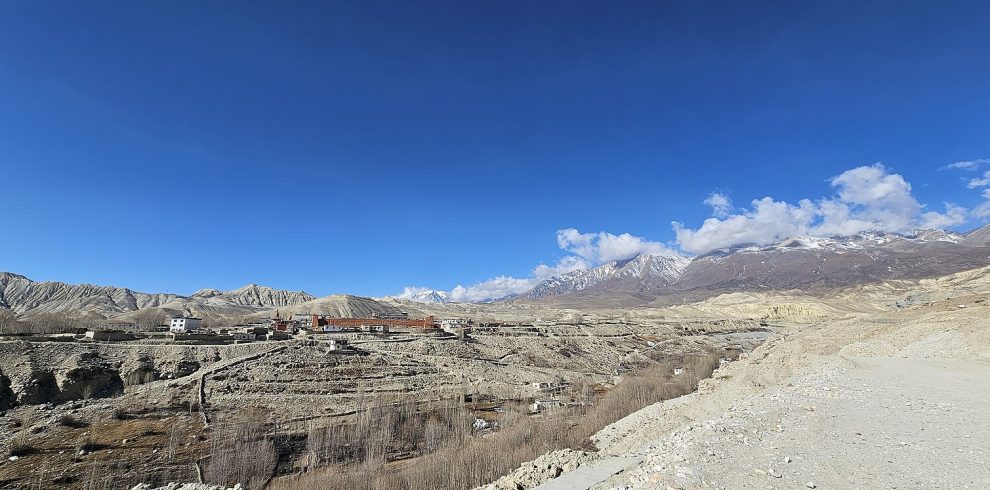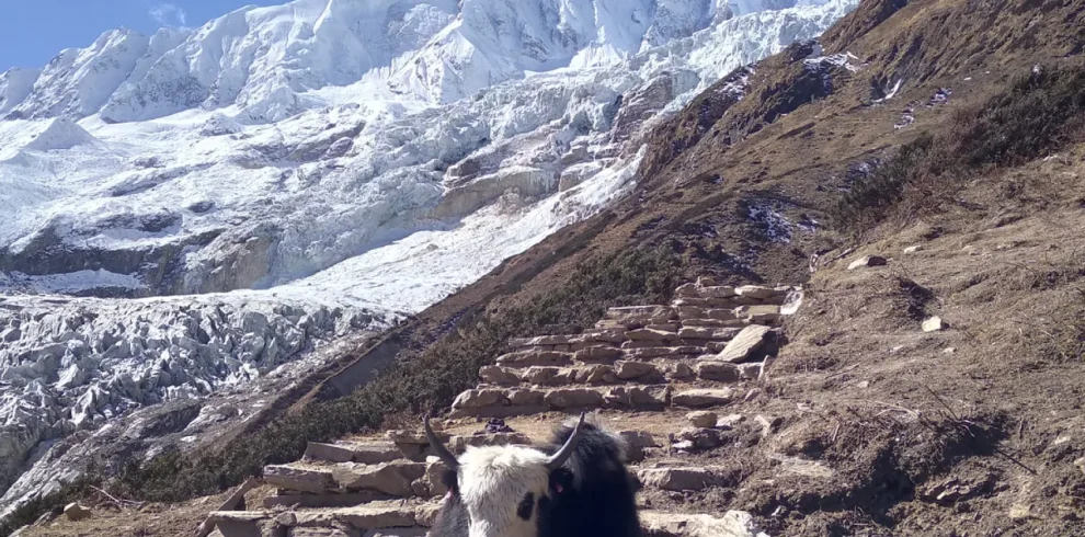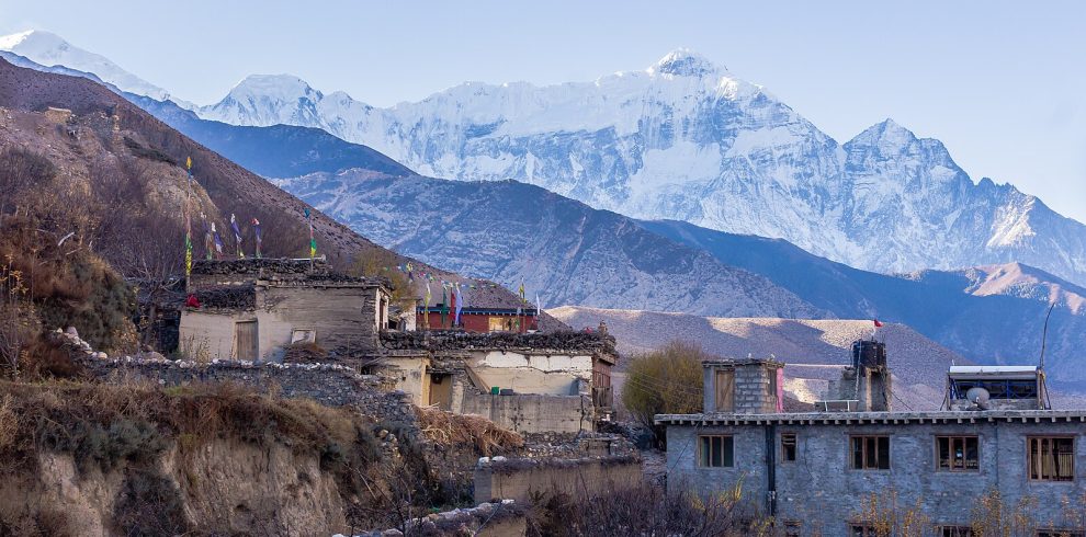
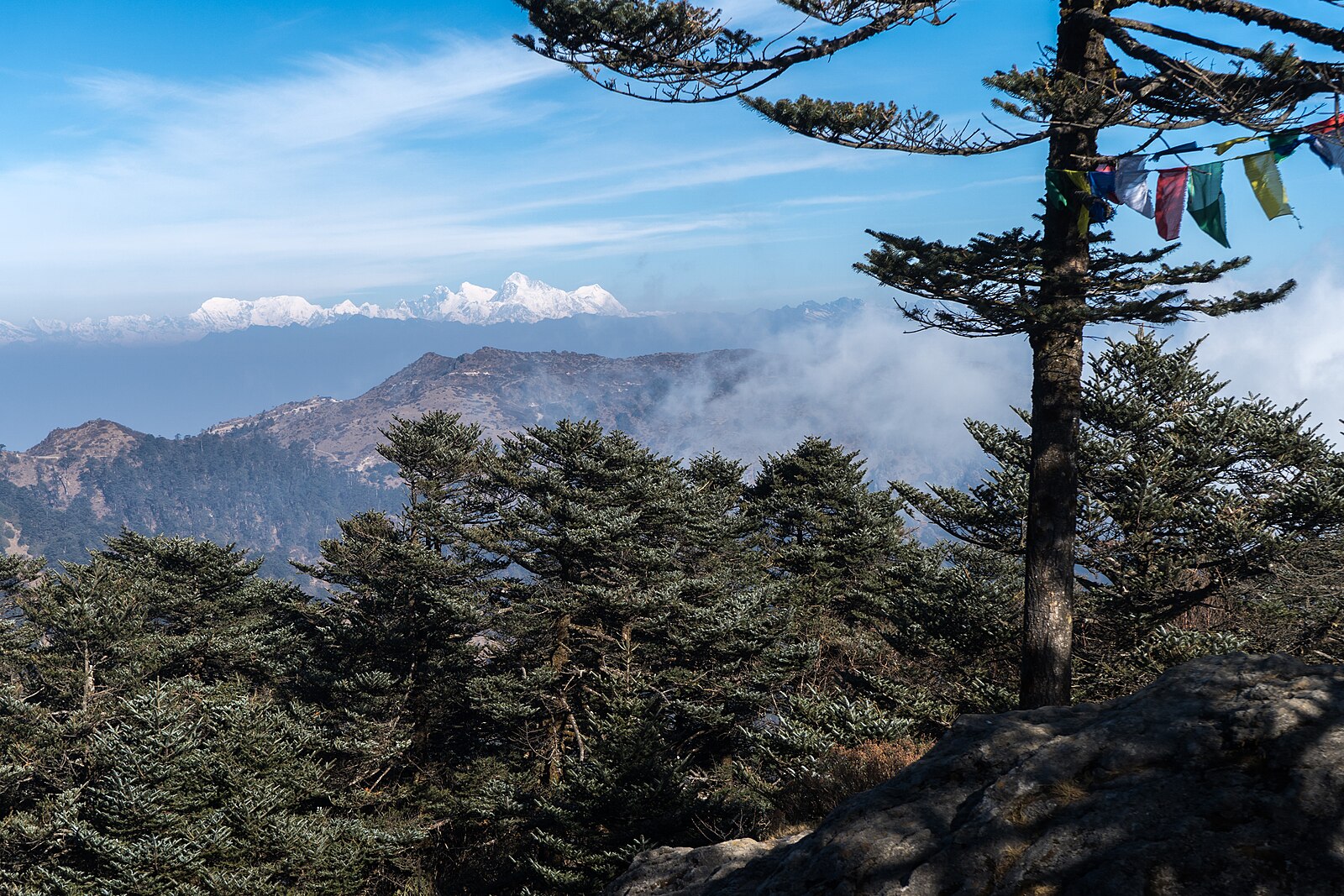
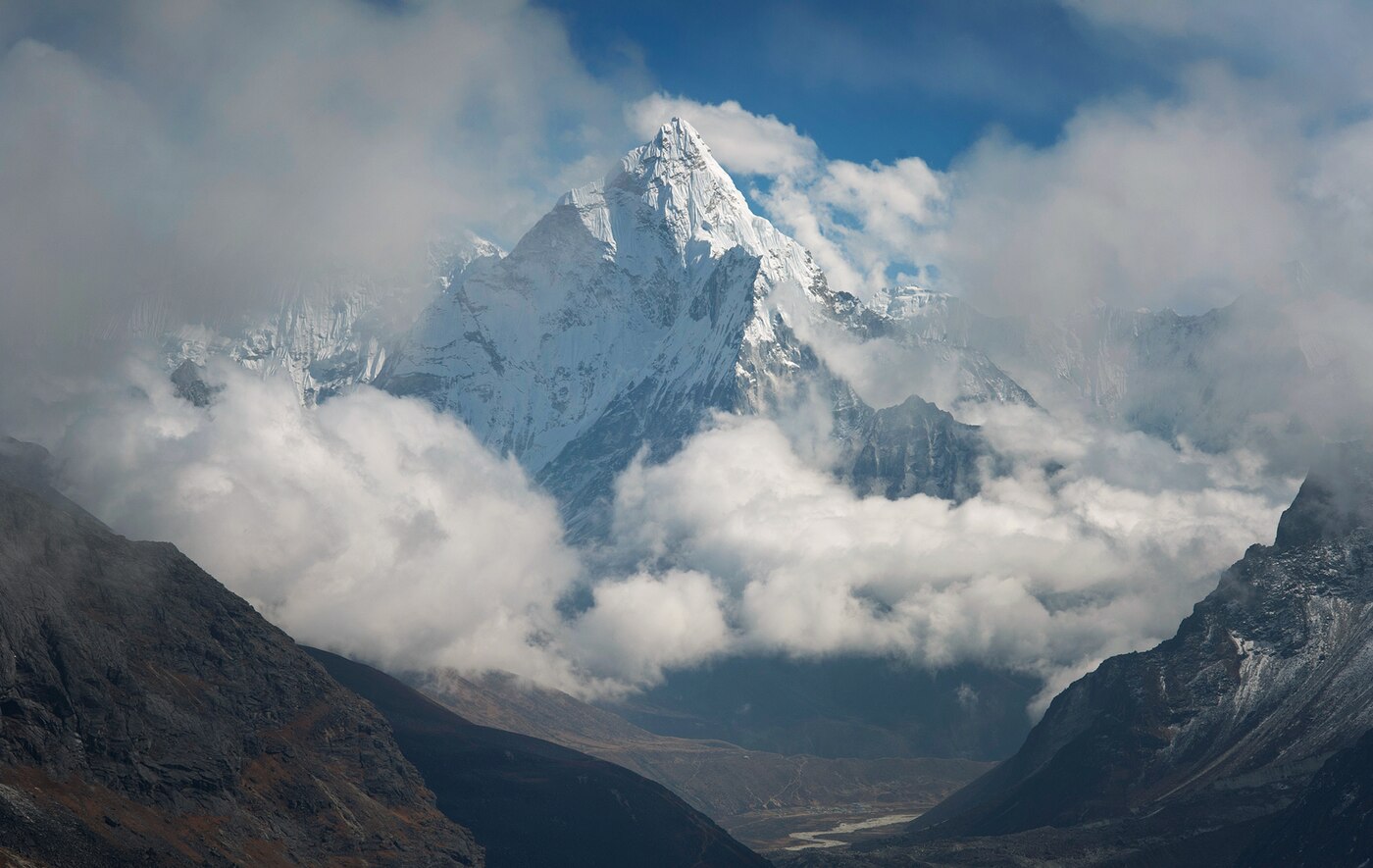
The Three Passes is the complete Khumbu. Instead of walking up one valley and back, you link all three of the region's major valleys by crossing the passes between them, taking in Everest Base Camp, Kala Patthar, the Gokyo Lakes and Gokyo Ri along the way.
This is not a first Himalayan trek. It demands previous multi-day experience and ideally prior time above 4,000m, but for those ready for it there is nothing better in Nepal.
Trip Highlights
- Kongma La (5,535m), the highest and quietest of the three passes
- Cho La (5,420m), a glacier crossing linking Everest to Gokyo
- Renjo La (5,360m), widely rated the finest viewpoint of the trek
- Everest Base Camp and Kala Patthar (5,545m)
- The Gokyo Lakes and Gokyo Ri (5,357m)
- The quiet western valleys around Thame, rarely seen by trekkers
Overview
The Three Passes is the complete Khumbu. Instead of walking up one valley and back, you link all three of the region's major valleys by crossing the passes between them, taking in Everest Base Camp, Kala Patthar, the Gokyo Lakes and Gokyo Ri along the way.
This is not a first Himalayan trek. It demands previous multi-day experience and ideally prior time above 4,000m, but for those ready for it there is nothing better in Nepal.
Trip Highlights
- Kongma La (5,535m), the highest and quietest of the three passes
- Cho La (5,420m), a glacier crossing linking Everest to Gokyo
- Renjo La (5,360m), widely rated the finest viewpoint of the trek
- Everest Base Camp and Kala Patthar (5,545m)
- The Gokyo Lakes and Gokyo Ri (5,357m)
- The quiet western valleys around Thame, rarely seen by trekkers
Trip Highlights
- Kongma La (5,535m), the highest and quietest of the three passes
- Cho La (5,420m), a glacier crossing linking Everest to Gokyo
- Renjo La (5,360m), widely rated the finest viewpoint of the trek
- Everest Base Camp and Kala Patthar (5,545m)
- The Gokyo Lakes and Gokyo Ri (5,357m)
- The quiet western valleys around Thame, rarely seen by trekkers
Itinerary of Everest Three Passes Trek – 18 Days
You are met at Tribhuvan International Airport and transferred to your hotel in Kathmandu. The rest of the day is yours to recover from the flight.
The Three Passes circuit is the most demanding of the standard Khumbu trekking routes. It crosses three passes above 5,300 m, spends the best part of a fortnight above 4,000 m, and involves glacier crossings on loose moraine. The afternoon briefing goes through all of this in detail along with the acclimatisation plan, which is what makes the route feasible.
Permits for Sagarmatha National Park and Khumbu Pasang Lhamu Rural Municipality are arranged now, so bring your passport and insurance documents. Cover to 6,000 m including helicopter evacuation is a requirement.
Gear matters more here than on the Base Camp route. You will need a four-season sleeping bag, proper insulated jacket, sturdy boots with good ankle support, and microspikes or crampons for the passes in some conditions - all available to hire or buy in Thamel, and your guide will come with you.
Overnight in a three-star hotel in Kathmandu.
An early transfer for the flight to Lukla, thirty-five minutes between the hills onto the short sloping runway at 2,860 m. Through the busiest weeks of spring and autumn the flight shifts to Ramechhap, meaning a road transfer that leaves Kathmandu in the small hours.
Loads are sorted and porters introduced over tea at Lukla, and then you walk out through the town gate onto the main trail north.
The first afternoon is short and gently downhill along the Dudh Koshi through Chheplung and Ghat. You pass the first of many mani walls and chortens - the convention is to keep them on your right as you walk, and it is a habit worth forming early.
Around three hours over 8 km, losing some 250 m. Starting easy is deliberate on a trek this long; there is no benefit in arriving tired at Namche.
Lunch and dinner at the lodge. Overnight in Phakding.
A serious climbing day. The trail works north along the Dudh Koshi, crossing the river on a succession of suspension bridges before you register at the national park entrance at Monjo and drop to Jorsalle.
Beyond the checkpost the Hillary Bridge spans the gorge at the confluence of the Dudh Koshi and Bhote Koshi, high enough that most people cross it without looking down.
From there the Namche hill climbs 600 m through pine forest in a long series of switchbacks over two to three hours. It is the first real test of the trek, and the pace you set here is a good indication of how the rest will go - slow and steady wins comfortably.
Namche Bazaar sits at 3,440 m in a natural amphitheatre facing Kongde Ri, a stack of lodges, bakeries and gear shops built into the hillside. It has been a trading centre between Tibet and the Nepali lowlands for centuries, and the Saturday market still draws people from all over the region.
Six to seven hours over 11 km with around 830 m of ascent. All meals provided. Overnight in Namche.
Your first acclimatisation day, and the pattern for those that follow: climb high, sleep low. Sitting still at 3,440 m does far less good than gaining several hundred metres and coming back down.
The morning walk climbs the steep zigzags behind Namche past the Syangboche airstrip to the Everest View Hotel at 3,880 m, where the terrace looks straight out at Everest, Lhotse, Nuptse and Ama Dablam.
From there you descend into Khumjung, whose monastery is said to hold a yeti scalp, and Khunde, where the hospital founded by Edmund Hillary in 1966 still serves the valley, before looping back down to Namche.
The afternoon is free. This is the last place with dependable ATMs, hot showers and internet, so it is worth drawing cash and charging everything now - power above here is solar, metered, and expensive.
Four to five hours with 440 m gained and lost. All meals provided. Overnight in Namche.
The trail climbs out of Namche onto the high contour path and runs almost level along the valley wall, with Everest, Lhotse, Nuptse, Thamserku and Ama Dablam in view for most of the morning. It is among the most enjoyable stretches of walking in the Khumbu.
At Sanasa, where Tibetan traders spread jewellery and prayer flags on the trailside, the Gokyo path branches off to the left - you will come back down that way in a fortnight.
The trail then drops steeply to Phunki Tenga on the Dudh Koshi, where prayer wheels turn in the stream, and lunch is usually taken before the climb.
The afternoon ascent to Tengboche is 600 m of steady work through rhododendron and birch, ending on a broad saddle occupied by the largest monastery in the region. If the timing suits you can attend the afternoon prayers, with horns and chanting inside the hall.
Five to six hours over 10 km with around 700 m of ascent. All meals provided. Overnight in Tengboche.
It is worth being outside at first light. Sunrise at Tengboche catches Everest, Lhotse, Nuptse and Ama Dablam in turn and is one of the finest mornings of the trek.
The trail descends through forest to Deboche, crosses the Imja Khola high above a gorge, and climbs to Pangboche. The upper village holds the oldest gompa in the Khumbu, and the short detour up to it is worthwhile.
Above Pangboche the treeline is left behind for good and the valley opens into the broad, bare Imja basin. Ama Dablam dominates to the right, and Island Peak becomes visible at the head of the valley.
Dingboche at 4,410 m is a scattered village of stone-walled fields where barley and potato are grown at an altitude that seems improbable - the walls exist to shelter the crops from the wind that funnels down the valley every afternoon.
Five to six hours over 12 km with around 550 m of ascent. All meals provided. Overnight in Dingboche.
A critical acclimatisation day. From here the route commits to sustained high altitude, and the Kongma La in two days' time is the highest of the three passes at 5,535 m.
The walk is the climb up Nangkartshang Ridge behind the village, a steep but straightforward ascent of around 600 m to a prayer-flag high point at roughly 5,080 m, taking three to four hours there and back.
From the ridge Makalu appears to the east - the world's fifth highest mountain, and not visible from lower down - with Ama Dablam opposite, Lhotse and Island Peak up the Imja valley, and Cholatse and Taboche to the west.
The afternoon is free. Drink three to four litres, eat properly whether or not you feel like it, and be straightforward with your guide about headaches or breathlessness. On this route in particular there is no sense in going up while you are still catching up.
Three to four hours with 600 m gained and lost. All meals provided. Overnight in Dingboche.
A short, easy day whose purpose is altitude rather than distance. The trail runs east up the Imja valley on a gentle gradient, following the river through open country with almost no vegetation.
The walls of the valley close in as you go, with Ama Dablam behind you, the immense south face of Lhotse ahead and Island Peak - Imja Tse - standing at the head of the valley looking exactly like the island in a sea of ice that gave it its name.
Chhukung at 4,730 m is a small collection of lodges at the end of the valley, used mainly by Island Peak climbers and Three Passes trekkers. It is a bleak spot but the setting is magnificent.
Arriving by early afternoon leaves time for the optional climb towards Chhukung Ri, an hour or two up the ridge behind the lodges, which is excellent preparation for tomorrow.
Three to four hours over 6 km with around 320 m of ascent. All meals provided. Overnight in Chhukung.
The first and hardest of the three passes. You leave around four in the morning for a long climb north-west up a steep boulder field towards the Kongma La, passing frozen tarns beneath the Nuptse wall.
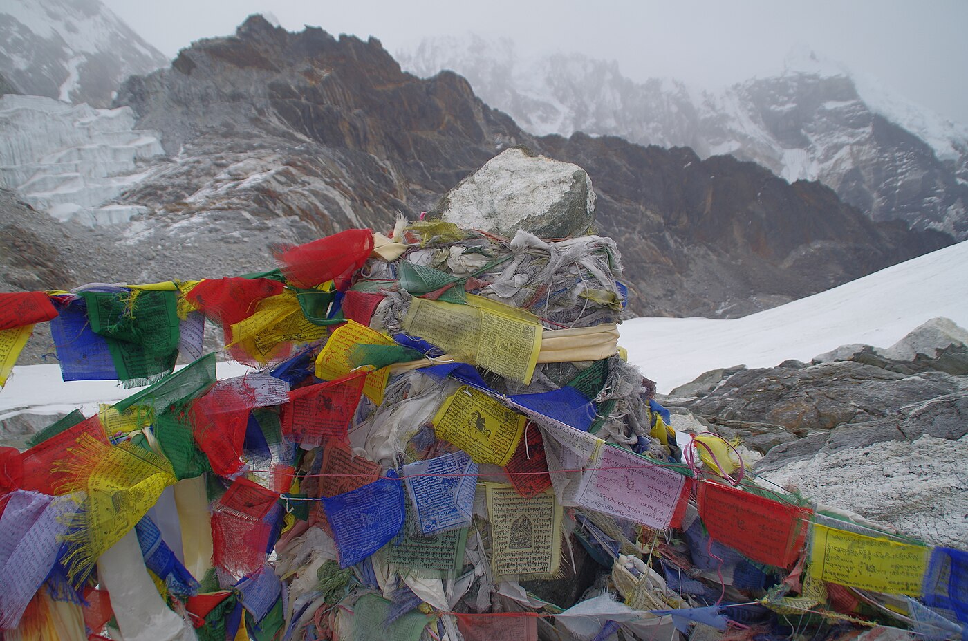
The Kongma La at 5,535 m is the highest point of the whole circuit. The final approach is a scramble over loose rock with a short steep section below the col, and in snow it can require care and, occasionally, microspikes. The col itself carries cairns and prayer flags and looks back over the Imja valley and forward to Pumori and the Khumbu.
The descent is demanding: a steep drop to the edge of the Khumbu Glacier, then a crossing of the glacier itself over unstable rubble-covered ice where the route is marked by cairns and changes from season to season. Your guide leads this section closely.
Climbing out of the far moraine brings you onto the main Base Camp trail just below Lobuche at 4,940 m.
Eight to nine hours with around 800 m of ascent and 600 m of descent. All meals provided. Overnight in Lobuche.
A long day on the classic Base Camp route. The trail follows the rough lateral moraine of the Khumbu Glacier north, over boulder fields and glacial streams, with the path shifting slightly year on year as the ice moves.
Around three hours brings you to Gorak Shep at 5,164 m, a few lodges on the sandy floor of a drained glacial lake. You leave your main pack here and take an early lunch.
The afternoon walk out to Everest Base Camp takes two to three hours over rock and moraine. At 5,364 m the camp sits directly beneath the Khumbu Icefall, a frozen cascade of collapsing seracs pouring out of the Western Cwm, with Nuptse and Pumori above. In April and May it is a tented city; at other times it is bare ice, and quieter.
Everest itself is hidden behind Nuptse from here, which catches many people out - the view of the mountain comes tomorrow morning.
Seven to eight hours over 15 km. All meals provided. Overnight at Gorak Shep.
An early start in the dark for Kala Patthar at 5,545 m, a steep two to three hour climb on rock and scree above Gorak Shep.
The summit gives the definitive view of Everest - the whole south-west face from the Khumbu Icefall to the summit pyramid, usually with a plume of spindrift streaming off the top, flanked by Nuptse, Lhotse, Changtse and Pumori directly above. For most people it is the single best hour of the trek.
You descend for breakfast, then retrace the moraine down to Lobuche and turn west, leaving the Base Camp trail for good. The path crosses the Khumbu Khola and climbs gently across open hillside beneath Awi Peak.
Dzongla at 4,830 m is a handful of lodges on a grassy shelf beneath Cholatse and Taboche, with the Chola Tsho lake below. It is a beautiful and very quiet place to spend a night.
Seven to eight hours with 600 m of ascent and around 900 m of descent. All meals provided. Overnight in Dzongla.
The second pass, and the one that most people find the most serious. An early start climbs a steep rock gully and then a boulder field to reach the base of the Cho La glacier.
The crossing of the glacier is the crux of the trek. It is not technical mountaineering, but the ice is genuinely slippery, there are crevasses to be navigated and the route is roped in places. Microspikes or crampons are usually needed, and your guide fixes a line where conditions require it.
The Cho La at 5,420 m is a narrow notch hung with prayer flags, with Ama Dablam, Cholatse and Baruntse visible from the top and an abrupt drop on the western side.
The descent is steep and loose - scree and boulder-hopping for a couple of hours - before easing onto the moraine and reaching Thagnak, a small settlement on the eastern edge of the Ngozumpa glacier.
Seven to eight hours with around 600 m of ascent and 700 m of descent. All meals provided. Overnight in Thagnak.
A shorter but memorable day, crossing the Ngozumpa - the longest glacier in Nepal, running some 36 km down from Cho Oyu.
The crossing takes two to three hours over rubble-strewn ice, with the trail dipping into hollows, skirting meltwater pools of extraordinary blue, and climbing over ridges of moraine. The route is cairned but shifts each season, and the sound of the ice moving beneath the rubble is a constant undertone.
Climbing out of the western lateral moraine brings you suddenly to Gokyo, on the shore of Dudh Pokhari - the third and largest of the Gokyo lakes, a brilliant turquoise sheet of water beneath Gokyo Ri.
The contrast between the grey chaos of the glacier and the colour of the lake, reached within a few minutes, is one of the more striking transitions in the Khumbu. Arriving early leaves the afternoon free to rest.
Three to four hours over 6 km. All meals provided. Overnight in Gokyo.
An early climb up Gokyo Ri, which rises directly behind the village - a steep and unrelenting zigzag of some 570 m, taking two to three hours at this altitude.
The summit at 5,357 m is arguably the finest viewpoint in Nepal. Four eight-thousanders are visible at once - Everest, Lhotse, Makalu and Cho Oyu - with the Ngozumpa glacier winding away below, the chain of turquoise lakes strung along the valley floor, and Cholatse and Taboche across the way. It is a wider and more beautiful panorama than Kala Patthar.
After descending for a late breakfast the day is deliberately kept free, both to rest before the third pass and to allow time for the optional walk north along the shore to the fourth and fifth lakes.
Scoundrel's Viewpoint above the fifth lake looks straight up the Ngozumpa to the Everest massif and is well worth the extra two hours if you have the energy.
Three to six hours with 570 m gained and lost. All meals provided. Overnight in Gokyo.
The last of the three passes, and for many the most enjoyable. An early start crosses the outflow of Dudh Pokhari and climbs steadily west up a long valley of moraine and rock.
The ascent is sustained but less technical than the Cho La - mostly a steep walk on rock and old snow, with a final rocky staircase to the col. It takes four to five hours.
Renjo La at 5,360 m gives what many people consider the best single view of the entire circuit: Everest, Lhotse and Makalu framed across the Gokyo valley, with Dudh Pokhari a brilliant blue directly below and the Ngozumpa glacier stretching north. Because it looks back at ground you have walked, it is a fitting place to finish the high section.
The descent is steep at first down a stone staircase, then eases into the Bhote Koshi valley - green, quiet and almost entirely free of other trekkers - to Lumde.
Seven to eight hours with 570 m of ascent and around 1,000 m of descent. All meals provided. Overnight in Lumde.
A long descending day down the Bhote Koshi valley, one of the least visited corners of the Khumbu and all the better for it.
The trail follows the river south through Marulung and Taranga, dropping steadily out of the alpine zone and back into juniper and then rhododendron. Yak pastures, stone-walled fields and old chortens line the route.
Thame is a substantial Sherpa village and one of the most historically significant in the region - the home village of Tenzing Norgay and of Apa Sherpa, who has summited Everest twenty-one times. Its monastery is set spectacularly on a cliff shelf above the village and is worth the climb up to it.
From Thame the trail contours east above the Bhote Koshi and rejoins the main route into Namche in the late afternoon, where hot showers, bakeries and a proper menu are waiting after two weeks without them.
Six to seven hours over 18 km, descending around 900 m. All meals provided. Overnight in Namche.
The final walking day. The trail drops sharply out of Namche to the Hillary Bridge, then follows the Dudh Koshi down through Jorsalle and Monjo, where you sign out of the national park.
The air thickens noticeably and the valley greens as you lose height, with pine forest and terraced fields returning after a fortnight above the trees.
From Phakding the route undulates rather than descends, and the short climbs through Ghat and Chheplung feel disproportionately hard at the end of a trek this long. The last pull into Lukla finishes it.
The evening is spent with the guides and porters over a final dinner - the customary moment for tips, and after eighteen days and three high passes, a well-earned one.
Six to seven hours over 19 km with 850 m of descent and 300 m of ascent. All meals provided. Overnight in Lukla.
An early transfer to Lukla airport for the thirty-five minute flight to Kathmandu, or to Ramechhap with an onward road transfer depending on the season. Flights operate at dawn before the wind rises in the valley.
Delays are a normal part of flying in and out of Lukla, and on a trek of this length we strongly recommend at least one buffer day in Kathmandu before an international departure. A helicopter transfer can usually be arranged at extra cost if the weather stays closed.
You are met on arrival and transferred to your hotel, where the trip ends. The rest of the day is free, and after eighteen days a long hot shower tends to take priority over everything else.
In the evening there is a farewell dinner at a Nepali restaurant in the city, usually with music and dance.
Breakfast and dinner provided. Overnight in Kathmandu. Airport transfers for your departure are included.
Cost Includes/Excludes
Cost Includes
- Airport transfers and hotel nights in Kathmandu with breakfast
- Kathmandu to Lukla return flights including airport taxes
- Sixteen nights teahouse accommodation on a twin-sharing basis
- All meals during the trek: breakfast, lunch and dinner
- Government-licensed English-speaking Sherpa guide and assistant guide
- One porter shared between two trekkers (up to 20kg)
- Sagarmatha National Park and Khumbu Pasang Lhamu permits
- Group safety equipment including rope and crampons for Cho La
- Guide and porter wages, insurance, meals and accommodation
- First aid kit, pulse oximeter and emergency oxygen
- All applicable government taxes
Cost Excludes
- International flights and Nepal visa fees
- Lunch and dinner in Kathmandu
- Travel and medical insurance with cover to 5,600m including helicopter evacuation
- Personal trekking equipment and clothing
- Drinks, hot showers, Wi-Fi and charging on the trail
- Extra nights caused by pass closures or flight delays
- Tips for guide and porter
FAQs
No technical climbing is involved, but you need previous multi-day trekking experience and ideally time above 4,000m. Cho La can hold ice, and we carry crampons and rope for the group.
Weather closes the passes regularly. Your guide will reroute via the valley trails, which keeps the trip running without the crossing. We build a contingency day into the schedule for this reason.
Anticlockwise, as in this itinerary, gives a better acclimatisation profile before Kongma La and puts Renjo La near the end when you are fully adapted.
Very. Expect eight to ten hour days on pass sections at altitudes above 5,300m, on consecutive days, for nearly three weeks. Sustained endurance training beforehand is essential.