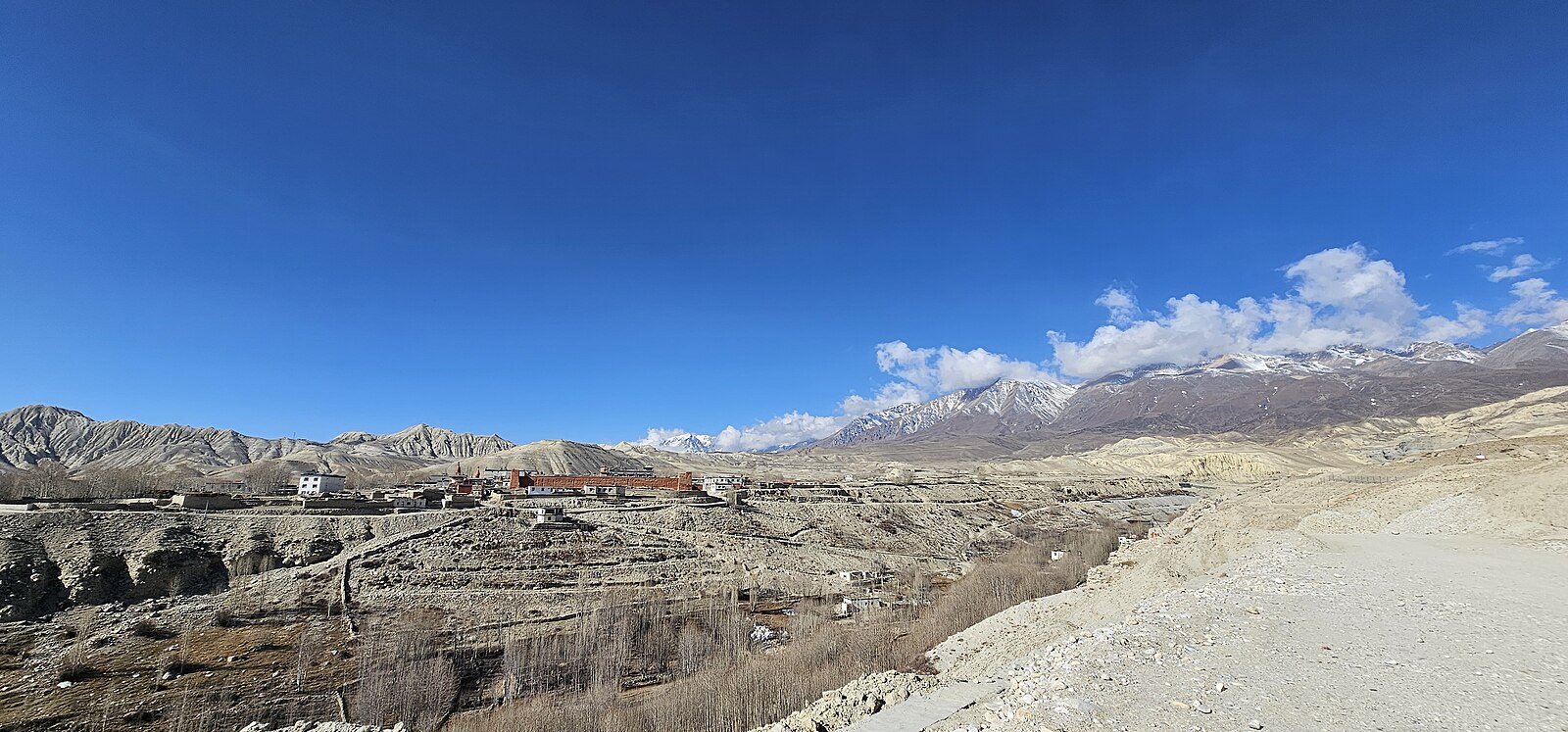
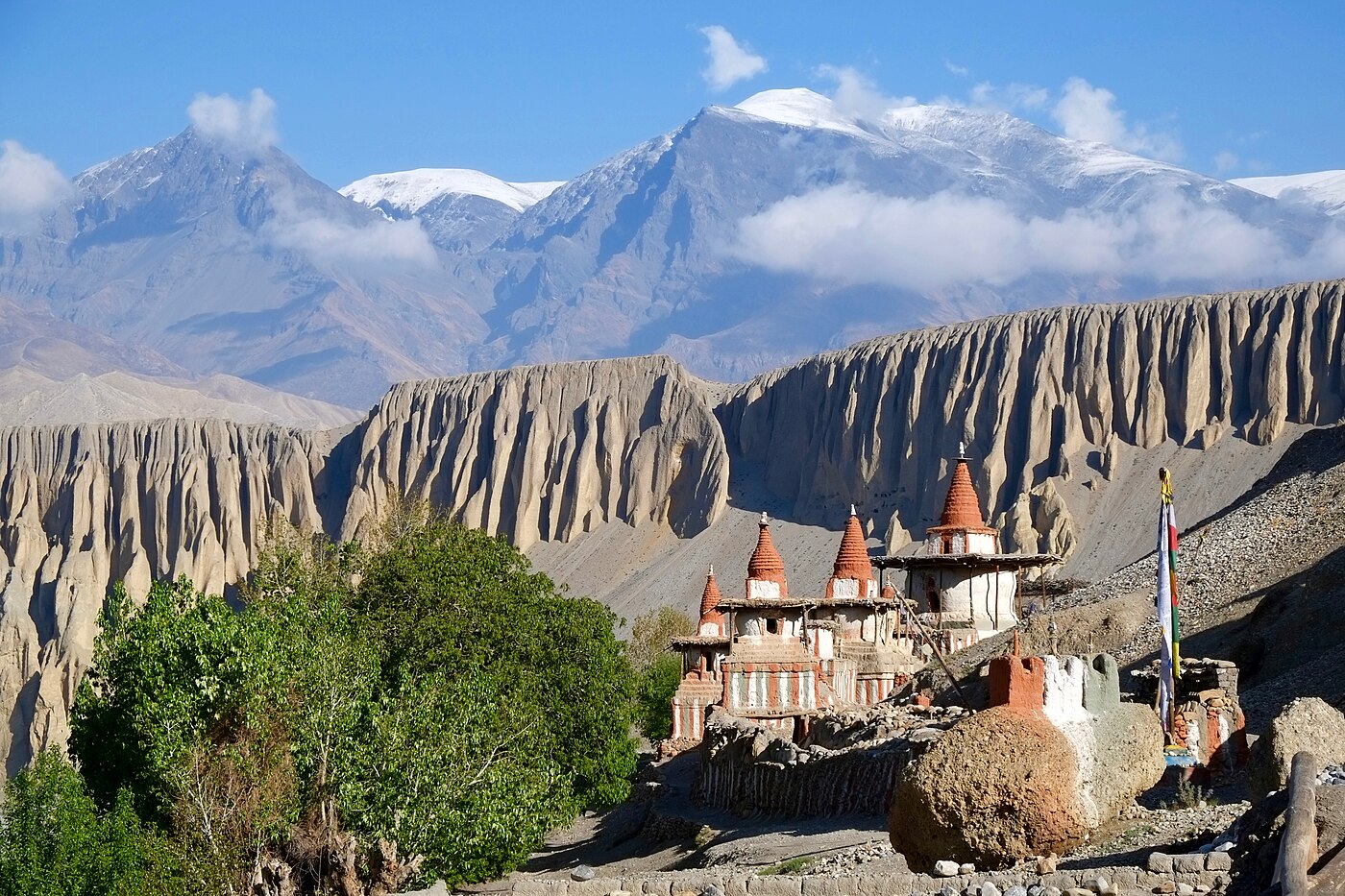
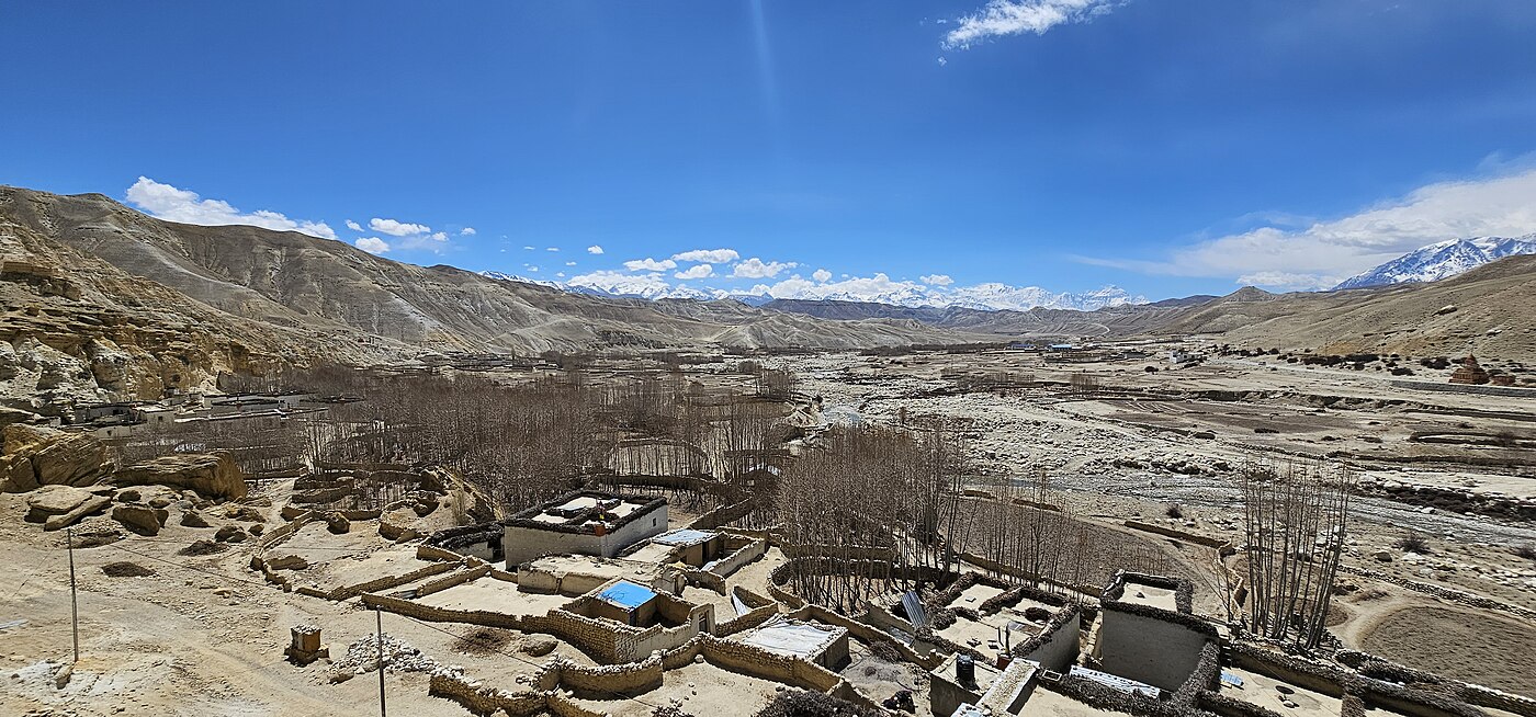
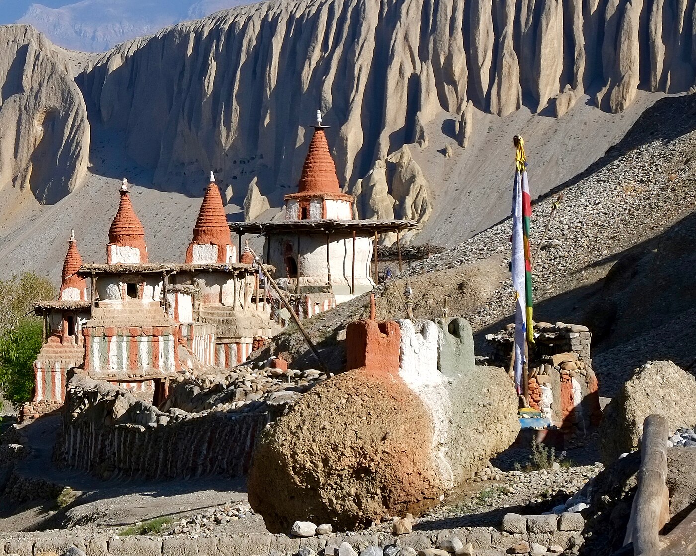
Upper Mustang was closed to outsiders until 1992, and the former Kingdom of Lo preserved its Tibetan Buddhist culture almost untouched. The landscape is arid and wind-carved, coloured in ochre and deep red, and it looks nothing like the rest of Nepal.
Because Mustang lies in the Himalayan rain shadow, this is also one of very few Nepali treks genuinely worth doing during the monsoon months.
Trip Highlights
- Lo Manthang, the walled capital of the former Kingdom of Lo
- Sky caves at Chhoser, cut into cliff faces and thousands of years old
- Ancient monasteries with remarkable original murals
- A high desert landscape unlike anywhere else in Nepal
- Trekkable during monsoon thanks to the rain-shadow position
- Two full nights in Lo Manthang to explore properly
Overview
Upper Mustang was closed to outsiders until 1992, and the former Kingdom of Lo preserved its Tibetan Buddhist culture almost untouched. The landscape is arid and wind-carved, coloured in ochre and deep red, and it looks nothing like the rest of Nepal.
Because Mustang lies in the Himalayan rain shadow, this is also one of very few Nepali treks genuinely worth doing during the monsoon months.
Trip Highlights
- Lo Manthang, the walled capital of the former Kingdom of Lo
- Sky caves at Chhoser, cut into cliff faces and thousands of years old
- Ancient monasteries with remarkable original murals
- A high desert landscape unlike anywhere else in Nepal
- Trekkable during monsoon thanks to the rain-shadow position
- Two full nights in Lo Manthang to explore properly
Trip Highlights
- Lo Manthang, the walled capital of the former Kingdom of Lo
- Sky caves at Chhoser, cut into cliff faces and thousands of years old
- Ancient monasteries with remarkable original murals
- A high desert landscape unlike anywhere else in Nepal
- Trekkable during monsoon thanks to the rain-shadow position
- Two full nights in Lo Manthang to explore properly
Itinerary of Upper Mustang Trek – 12 Days
You are met at Tribhuvan International Airport and transferred to your hotel in Kathmandu. The remainder of the day is free.
Upper Mustang is a restricted area and its permit is among the most expensive in Nepal, currently US$500 per person for ten days. It must be issued in your name through a registered agency, you must travel with a licensed guide, and a minimum of two trekkers is required on the permit. We arrange all of it, but we need your original passport for a day.
The restriction exists for good reason. Until 1992 the region was entirely closed to outsiders, and as the former Kingdom of Lo it retained its own monarchy until 2008. What survives there is one of the most intact traditional Tibetan Buddhist cultures anywhere, and visitor numbers are deliberately limited.
The afternoon briefing covers the route, the permits, and what to expect: this is high desert, arid and wind-scoured, with a fierce afternoon wind almost every day.
Overnight in a three-star hotel in Kathmandu.
The journey to Pokhara, either by the twenty-five minute flight - which runs the length of the Himalaya with Langtang, Manaslu, Annapurna and Dhaulagiri lined up along the windows - or by tourist coach along the Prithvi Highway, a scenic but slow six to seven hours beside the Trishuli river.
Pokhara sits at 820 m on the shore of Phewa Lake beneath the Annapurnas, and is a considerably more relaxed place than Kathmandu.
The afternoon is free. A boat out onto Phewa Lake to the Tal Barahi temple on its island is the classic thing to do, and the walk or short climb up to the World Peace Pagoda on the ridge above gives a fine view over the lake to Machhapuchhre and Annapurna South.
The lakeside strip has good restaurants and the last decent coffee before the trek. Any final gear can be bought here.
Breakfast provided. Overnight in a hotel in Pokhara.
A very early transfer for the twenty-minute flight to Jomsom. The aircraft flies directly up the Kali Gandaki between Annapurna I and Dhaulagiri, both over 8,000 m, through what by that measure is the deepest gorge on earth. Flights go at dawn because the valley wind makes later landings impossible.
Jomsom at 2,720 m is the administrative centre of Mustang, a strip of buildings along a wide braided riverbed. After permit checks and breakfast you begin walking north.
The trail follows the Kali Gandaki upstream, mostly along the gravel riverbed between bare cliffs, with the wind building at your back through the morning. The landscape is arid and treeless, a complete contrast to the green hills south of the range.
Kagbeni appears as a sudden block of irrigated green: a medieval walled village of mud-brick alleys, a red gompa and barley fields, standing at the gateway to Upper Mustang. The restricted-area checkpost is here, and beyond it the permit becomes essential.
Three to four hours over 10 km. All meals provided. Overnight in Kagbeni.
Through the checkpost and into the restricted area. The trail climbs above the Kali Gandaki to Tangbe, a village of whitewashed houses, narrow alleys and apple orchards set among fields of buckwheat.
From Tangbe the path continues to Chhusang, then crosses the river beneath a remarkable cliff face riddled with ancient cave dwellings - hundreds of man-made caves cut high into the rock, some dating back three thousand years, whose purpose is still not fully understood.
The route then climbs steeply away from the river to Chele at 3,050 m. The landscape through the day is extraordinary: eroded cliffs in red, ochre, grey and purple, wind-carved rock formations, and almost no vegetation beyond the irrigated village strips.
The afternoon wind here is strong and constant, typically rising around eleven, which is why the walking days start early.
Five to six hours over 14 km with around 250 m of net ascent. All meals provided. Overnight in Chele.
A demanding day with two significant passes. The trail climbs steeply out of Chele up a narrow canyon to the Taklam La at around 3,620 m, then crosses the Dajori La at 3,735 m.
From these passes the views are enormous and utterly barren: Nilgiri, Tilicho Peak, Yakawa Kang and Damodar Danda across a landscape of eroded badlands with no trees or scrub anywhere in sight.
The route descends to Samar, a green village of poplars in an otherwise dry valley, then continues past the Rangbyung cave - a sacred site containing naturally formed rock stalagmites revered as self-arisen images of Buddhist deities, one of the important pilgrimage places of Mustang.
A final climb over the Bhena La brings you to Syangboche at 3,800 m, a small settlement of a few houses and lodges on an exposed shoulder.
Six to seven hours over 15 km with around 750 m of ascent. All meals provided. Overnight in Syangboche.
The trail crosses the Yamda La at 3,850 m and descends to Ghiling, a substantial village with a gompa and, unusually for Mustang, a good stand of trees.
From Ghiling the route climbs again to the Nyi La at around 4,010 m, the highest point reached so far and effectively the boundary between Lower and Upper Lo. The descent on the far side leads towards Ghami.
Just beyond the village stands the longest mani wall in Nepal, a stone wall several hundred metres long carved with mantras, built according to legend from the entrails of a demon subdued by Guru Rinpoche - the surrounding red cliffs are said to be its blood.
Ghami at 3,520 m is one of the largest villages in the region, a compact settlement of whitewashed and ochre houses surrounded by barley fields and irrigation channels.
Five to six hours over 14 km with around 500 m of ascent and 800 m of descent. All meals provided. Overnight in Ghami.
A shorter day. The trail descends from Ghami, crosses the Ghami Khola, and passes alongside the great mani wall before climbing to the Tsarang La at around 3,870 m.
The country here is at its most striking - vast eroded cliffs banded in red and grey, deeply cut canyons, and a scale that is difficult to convey. The colours shift constantly through the day as the light moves.
Charang, also written Tsarang, at 3,560 m is the second largest settlement of Upper Mustang. A five-storey white dzong, or fortress, stands on the edge of a canyon beside a large red gompa dating from the fifteenth century.
The monastery holds an important collection of thangkas, statues and manuscripts and is usually open to visitors in the afternoon; the caretaker monk will show you round for a small donation.
Four to five hours over 10 km. All meals provided. Overnight in Charang.
The day you reach the walled capital. The trail descends from Charang, crosses the Charang Chu, and climbs steadily onto a high plateau of open, stony desert.
A final climb brings you to the Lo La at around 3,950 m, and from the pass Lo Manthang is suddenly laid out below - a compact rectangle of white walls enclosing the entire town, standing alone on the plain with the Tibetan border only a few hours beyond and Nilgiri and Annapurna far to the south.
Founded in 1380, Lo Manthang was the capital of the Kingdom of Lo and remains one of the last intact walled settlements in the Himalaya. Its layout has changed very little in six centuries: a single gate, narrow lanes, the royal palace, and four major gompas within the walls.
You descend from the pass and enter through the gate in the early afternoon, which leaves time to walk the lanes and get your bearings.
Four to five hours over 11 km with around 400 m of ascent. All meals provided. Overnight in Lo Manthang.
A full day to explore the walled town and its surroundings, which is the whole point of coming this far.
Within the walls are three principal monasteries: Jampa Lhakhang, dating from the early fifteenth century and holding a monumental Maitreya Buddha and a remarkable series of mandala murals; Thubchen Gompa, a vast assembly hall with massive wooden columns, restored over many years by international conservation teams; and the red Chodey Gompa, still the active monastery of the town. The four-storey former royal palace stands beside them.
In the afternoon a popular excursion is the ride or drive north to Chhoser, where the Jhong cave complex - a five-storey warren of some forty rooms cut into a cliff face, connected by ladders and used as a dwelling and refuge for centuries - is open to visitors, along with the nearby Nyphu cave monastery.
Horses can be hired locally for the day, which is the traditional way to cover this ground and considerably easier than walking it.
Around four to six hours of walking or riding. All meals provided. Overnight in Lo Manthang.
The return south takes a different and less travelled route, over the high western side rather than retracing the outward trail.
The path climbs from Lo Manthang over the Chogo La at around 4,230 m, the highest point of the trek, giving a final long view back over the walled town and north towards the Tibetan plateau.
The descent leads to Ghar Gompa, said to be the oldest monastery in Mustang and pre-dating Samye in Tibet - founded in the eighth century in connection with Guru Rinpoche. It is a small, atmospheric building with fine old wall paintings, and local belief holds that a wish made here is granted.
From there the trail drops to Drakmar at 3,810 m, set beneath dramatic red cliffs - the colour, in local legend, coming from the blood of the demon slain by Guru Rinpoche.
Six to seven hours over 17 km with around 400 m of ascent and 800 m of descent. All meals provided. Overnight in Drakmar.
A jeep day rather than a walking day, taking the rough road south through the heart of Mustang back to Jomsom.
The track climbs over the passes and drops through Ghami, Ghiling and Samar, giving you a second view of country you walked through northbound, seen at speed and from a different angle. It is dusty and bumpy, and the scenery remains extraordinary throughout.
The road descends to Kagbeni and rejoins the main Kali Gandaki valley, following the riverbed south to Jomsom. Total travel time is around five to six hours depending on conditions.
Arriving in Jomsom in the afternoon there is time to walk through the bazaar or visit the small Mustang Eco Museum, and to enjoy a hot shower and a wider menu than anything in the restricted area.
All meals provided. Overnight in Jomsom.
An early flight from Jomsom to Pokhara, twenty minutes back down the gorge between Dhaulagiri and Annapurna, timed before the valley wind rises. If weather closes the airstrip we transfer you by road to Pokhara instead, which takes most of the day.
From Pokhara you continue to Kathmandu by the afternoon flight or by tourist coach, and are transferred to your hotel on arrival.
Because both flights on this route are weather-dependent, we recommend keeping at least one buffer day in Kathmandu before any international departure.
The trip ends in Kathmandu. The evening is free, and Thamel is the obvious place for souvenirs after two weeks in country where there is very little to buy.
Breakfast provided. Overnight in Kathmandu. Airport transfers for your onward flight are included.
Cost Includes/Excludes
Cost Includes
- Airport transfers and hotel nights in Kathmandu and Pokhara with breakfast
- Pokhara to Jomsom and Jomsom to Pokhara flights
- Drakmar to Jomsom jeep transfer
- Nine nights teahouse and lodge accommodation on a twin-sharing basis
- All meals during the trek: breakfast, lunch and dinner
- Upper Mustang Restricted Area Permit (10 days)
- Annapurna Conservation Area (ACAP) permit
- Government-licensed English-speaking trekking guide
- One porter shared between two trekkers (up to 20kg)
- Guide and porter wages, insurance, meals and accommodation
- All applicable government taxes
Cost Excludes
- International flights and Nepal visa fees
- Lunch and dinner in Kathmandu and Pokhara
- Travel and medical insurance including helicopter evacuation cover
- Personal trekking equipment and clothing
- Drinks, hot showers, Wi-Fi and charging on the trail
- Monastery donations and camera fees at some sites
- Extra nights caused by Jomsom flight delays
- Tips for guide and porter
FAQs
The Restricted Area Permit alone costs around USD 500 per person for ten days, plus roughly USD 50 for each extra day. That single fee accounts for most of the price difference against comparable Annapurna treks.
No. A minimum of two trekkers and a government-licensed guide are required, and permits must be issued through a registered agency. We can pair solo travellers with a group departure.
Yes, unusually so. Mustang sits north of the main Himalayan range in the rain shadow, so June to August stays comparatively dry while most of Nepal is unwalkable.
Moderate rather than hard. You cross repeated passes between 3,500m and 4,200m but sleep no higher than 3,840m. The main challenges are daily distance, strong afternoon wind and very dry air.