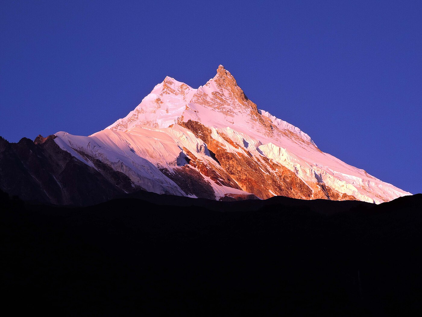
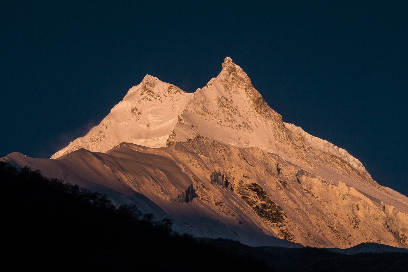
Manaslu is the circuit that experienced trekkers recommend to each other. It loops around the world's eighth-highest mountain, crossing the 5,106m Larke La, and it carries a fraction of the traffic of Annapurna despite comparable scenery.
Because Manaslu is a restricted area, a licensed guide and a minimum of two trekkers are legally required. We handle the permits and can pair solo travellers with an existing departure.
Trip Highlights
- A true circuit around Manaslu (8,163m) with no backtracking
- Crossing the Larke La (5,106m)
- Samagaon, with Manaslu Base Camp and Birendra Lake nearby
- Strong Tibetan Buddhist culture in the upper Nubri valley
- Climate zones from subtropical gorge to high alpine desert
- Far quieter than the Annapurna or Everest circuits
Overview
Manaslu is the circuit that experienced trekkers recommend to each other. It loops around the world's eighth-highest mountain, crossing the 5,106m Larke La, and it carries a fraction of the traffic of Annapurna despite comparable scenery.
Because Manaslu is a restricted area, a licensed guide and a minimum of two trekkers are legally required. We handle the permits and can pair solo travellers with an existing departure.
Trip Highlights
- A true circuit around Manaslu (8,163m) with no backtracking
- Crossing the Larke La (5,106m)
- Samagaon, with Manaslu Base Camp and Birendra Lake nearby
- Strong Tibetan Buddhist culture in the upper Nubri valley
- Climate zones from subtropical gorge to high alpine desert
- Far quieter than the Annapurna or Everest circuits
Trip Highlights
- A true circuit around Manaslu (8,163m) with no backtracking
- Crossing the Larke La (5,106m)
- Samagaon, with Manaslu Base Camp and Birendra Lake nearby
- Strong Tibetan Buddhist culture in the upper Nubri valley
- Climate zones from subtropical gorge to high alpine desert
- Far quieter than the Annapurna or Everest circuits
Itinerary of Manaslu Circuit Trek – 15 Days
You are met at Tribhuvan International Airport and transferred to your hotel in Kathmandu. The remainder of the day is free to rest after the flight or to walk into Thamel.
Manaslu is a restricted area, and the permit process is more involved than for Everest or Annapurna. A restricted-area permit must be issued in your name through a registered agency, you must travel with a licensed guide, and there is a minimum of two trekkers on the permit. We handle all of this, but we need your original passport for a day and passport photographs.
The afternoon briefing covers the route, the Larke La crossing, altitude management and the kit you will need. The circuit reaches 5,106 m and the pass day is long, so this is worth listening to closely.
Any remaining gear can be bought or hired in Thamel. A four-season sleeping bag and proper insulated jacket are not optional on this route - the lodges above Samagaon are unheated.
Overnight in a three-star hotel in Kathmandu.
A long day on the road, heading west out of Kathmandu on the Prithvi Highway beside the Trishuli river, then turning north at Dhading Besi towards the Budhi Gandaki valley.
The sealed road ends well before Arughat and the remainder is rough unsealed track, narrow in places and cut into steep hillsides above the river. It is slow going, but the valley scenery through here - terraced hillsides, suspension bridges, roadside villages - is worth the discomfort.
The route passes Arughat and Soti Khola before reaching Machha Khola at 870 m, a small riverside village whose name means fish stream. Permits are checked along the way.
Total travel time is eight to ten hours depending on conditions, and in the monsoon months landslides can add considerably to that. Take a seat towards the front if you are prone to motion sickness.
Lunch en route, dinner at the lodge. Overnight in Machha Khola.
The trek begins in earnest. The trail follows the Budhi Gandaki upstream through a warm, humid, deeply cut gorge, crossing and recrossing the river on suspension bridges as it works north.
You pass Khorlabesi and then Tatopani, where hot springs emerge beside the trail - worth a brief stop even early in the day. Beyond it the path climbs over a ridge on a staircase carved into the rock and drops back to the river at Dobhan.
This lower section is subtropical: banana and bamboo, terraced rice, langur monkeys in the trees and butterflies along the path. It is a striking contrast to the high country waiting a week ahead.
Jagat at 1,340 m is a neat stone-paved village and the official entry checkpoint for the Manaslu Conservation Area, where your restricted-area permits are inspected properly for the first time.
Six to seven hours over 22 km with around 470 m of net ascent. All meals provided. Overnight in Jagat.
The valley narrows sharply today and the walking becomes more dramatic. The trail climbs to Salleri, then descends to Sirdibas and crosses the Budhi Gandaki on a long suspension bridge to Ghatta Khola.
A steady climb through Philim, a large Gurung village of stone houses and terraced fields, brings you to the point where the Tsum Valley trail branches north-east. The main route continues north into an increasingly steep-sided gorge.
Beyond Philim the valley closes to a slot, with the trail cut into cliff faces above the river and passing through bamboo and pine forest. There are several sections of trail carved directly out of the rock, and the walking here is genuinely spectacular.
The first Buddhist mani walls and chortens appear around Deng, marking the transition from Hindu-influenced lower villages to the Tibetan-descended communities of the upper valley.
Six to seven hours over 20 km with around 520 m of ascent. All meals provided. Overnight in Deng.
The trail crosses the Budhi Gandaki and climbs steadily through pine and rhododendron forest, gaining serious height today as the valley finally begins to open out.
You pass through Rana, Bihi Phedi and Ghap, where a long mani wall carved with Tibetan script runs beside the path. Prayer flags, chortens and kani gateways - archways painted inside with Buddhist murals, which you walk through on entering and leaving a village - become constant features from here on.
The forest through this section is dense and mossy, with waterfalls crossing the trail. Above Ghap the path climbs more steeply, and the first proper Himalayan peaks come into view.
Namrung at 2,630 m sits on a shelf with a police checkpost and the first clear views of Himal Chuli and Ganesh Himal. The village is unmistakably Tibetan in architecture and language, and yaks appear from here upward.
Six to seven hours over 19 km with around 770 m of ascent. All meals provided. Overnight in Namrung.
A shorter but scenically outstanding day. The trail climbs through Lihi, a village with several chortens and barley fields, then contours around the valley through Sho and Shrip with the mountains growing steadily larger.
Manaslu itself, at 8,163 m the eighth highest mountain in the world, comes into full view during the morning, along with Manaslu North and Naike Peak. The name derives from the Sanskrit for intellect or soul, and the mountain is regarded locally as the abode of a protective deity.
The country here is high, dry and open, with juniper and dwarf birch replacing the forest below. Fields of barley and potato are terraced on every workable slope.
Lho at 3,180 m is a substantial village dominated by the Ribung Gompa above it, reached by a short climb and well worth doing in the late afternoon for the view of Manaslu from its courtyard at sunset.
Four to five hours over 11 km with around 550 m of ascent. All meals provided. Overnight in Lho.
A short day into the heart of the Manaslu massif. The trail climbs gently from Lho through forest to Shyala, a small settlement in a natural amphitheatre with Manaslu directly ahead, Himal Chuli and Ngadi Chuli behind, and Naike Peak and the Manaslu glacier filling the view.
Many people rate Shyala the single most spectacular spot on the circuit, and it is worth stopping for tea simply to sit with the view for half an hour.
From Shyala the path contours across open hillside to Samagaon at 3,530 m, the largest village of the upper valley: a compact settlement of flat-roofed stone houses, a large gompa, and yak herds grazing the flats around it.
Samagaon is thoroughly Tibetan in culture and language, and largely unchanged in layout for centuries. Arriving early leaves the afternoon free to walk through the village and begin adjusting to the altitude.
Four to five hours over 9 km with around 350 m of ascent. All meals provided. Overnight in Samagaon.
A full acclimatisation day at 3,530 m before the higher stages. As always the day involves climbing rather than resting, and there are two excellent options.
Birendra Tal is the shorter walk: a milky turquoise glacial lake at around 3,690 m directly beneath the Manaslu glacier, about two hours there and back, with the icefall calving into it periodically.
The more demanding option continues past the lake and climbs to Manaslu Base Camp at roughly 4,800 m - a hard six to seven hour round trip, but it puts you at the foot of an eight-thousander and is superb acclimatisation. A third choice is the climb to Pungyen Gompa, an isolated monastery on a ridge with views over the glacier.
Whichever you choose, return to Samagaon to sleep and drink steadily through the day. This is also the last village of any size before the pass.
Two to seven hours depending on the option. All meals provided. Overnight in Samagaon.
A deliberately short day to keep the altitude gain gentle. The trail leaves Samagaon and follows the Budhi Gandaki north through a wide, open valley of yak pasture and dwarf juniper.
You pass the turning for the Manaslu Base Camp trail and a large kani gateway, then continue on a good path with Manaslu behind you and the Larke massif ahead. The landscape is now entirely alpine - no trees, wide horizons, and enormous skies.
Samdo at 3,860 m is the last permanent settlement before the pass, a village of some forty households originally settled by Tibetan refugees in the late 1950s. The Tibetan border lies only a few hours' walk north, and trade over the Lajyang La still goes on.
The afternoon is free, and a short walk up the ridge behind the village towards the border viewpoint is good acclimatisation and gives views into Tibet.
Three to four hours over 8 km with around 330 m of ascent. All meals provided. Overnight in Samdo.
Another short stage, again by design - you are now at serious altitude and the pass is tomorrow. The trail descends briefly to cross the Budhi Gandaki on a wooden bridge, then climbs steadily across bare, open hillside.
The walking is on scree and rough grass with no vegetation to speak of, following the valley up towards the Larke glacier. Blue sheep are frequently seen on these slopes, and occasionally the Himalayan griffon vultures that hunt them.
Dharamsala, also called Larke Phedi, at 4,460 m is not a village but a single basic lodge and a scatter of tents beneath the pass. Facilities are minimal: dormitory beds, limited food, no heating and unreliable water. It is a rough night, and everyone finds it so.
Arriving by early afternoon leaves time for a short walk uphill and back to aid acclimatisation, then an early meal and an early bed.
Three to four hours over 7 km with around 600 m of ascent. All meals provided. Overnight at Dharamsala.
The defining day of the circuit. You leave around four in the morning by head torch, both to reach the pass before the afternoon wind and because the descent on the far side is very long.
The climb is a steady three to four hours over moraine, scree and usually snow, passing frozen tarns and skirting the Larke glacier. The last section to the col is a slog of false summits at very thin air, and the cold before sunrise is severe.
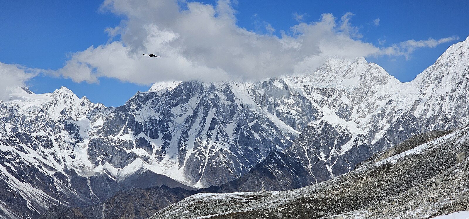
Larke La at 5,106 m is marked by cairns and a mass of prayer flags. The view is one of the finest on any Nepali pass: Himlung Himal, Cheo Himal, Gyaji Kang, Kang Guru and, ahead to the west, the whole Annapurna II massif opening up as you cross the watershed.
The descent is long, steep and hard on the knees - some 1,500 m over four to five hours, on loose scree at first, then grass and finally into the meadows and pines around Bimthang, a beautiful open valley beneath the Ponkar glacier.
Eight to ten hours in total, with 650 m of ascent and around 1,500 m of descent. All meals provided. Overnight in Bimthang.
A long descent out of the high country and back into inhabited valleys. The morning light on Manaslu from Bimthang is superb and worth getting up for before breakfast.
The trail drops through rhododendron and pine forest, crossing the Dudh Khola on a wooden bridge and passing through Yak Kharka and Karche. The vegetation thickens rapidly as height is lost, and within a few hours you are back among terraced fields and farmhouses.
The lower section follows the valley through Gho and Tilje, a substantial Gurung village where local raksi is distilled, before joining the Marsyangdi at Dharapani.
Dharapani at 1,970 m is on the Annapurna Circuit, and the change is immediate - road access, more lodges, and other trekkers after a week of seeing almost nobody.
Six to seven hours over 19 km, descending around 1,620 m. All meals provided. Overnight in Dharapani.
A jeep takes you down the Marsyangdi valley from Dharapani to Besisahar, roughly three to four hours on rough track through the gorge, with waterfalls crossing the road and the river below.
At Besisahar the sealed road resumes and you transfer to a vehicle for the drive east to Kathmandu along the Prithvi Highway, following the Trishuli river through Dumre and Mugling with a stop for lunch.
Total travel time is eight to ten hours, and it is a tiring day after two weeks of walking, but the road scenery through the middle hills is genuinely pleasant.
You are dropped at your hotel in Kathmandu in the evening. A hot shower and a bed that is not in an unheated stone lodge tend to be the immediate priorities.
Breakfast and lunch provided. Overnight in Kathmandu.
A free day in Kathmandu, built into the itinerary deliberately as a buffer - the Larke La can close in bad weather and the road from Dharapani is vulnerable to landslides, so having a spare day protects your international flight.
If all has gone to schedule, the day is yours. A guided tour of the valley's UNESCO sites can be arranged: Swayambhunath, the hilltop stupa above the city; Boudhanath, one of the largest stupas in the world and the centre of Tibetan Buddhist life in Nepal; Pashupatinath on the Bagmati; and Patan Durbar Square with its Newar architecture and museum.
Otherwise Thamel is the place for souvenirs, and prices there are markedly better than anything on the trail.
In the evening there is a farewell dinner at a Nepali restaurant, usually with traditional music and dance.
Breakfast and dinner provided. Overnight in Kathmandu.
The trip ends today. Depending on your flight time the morning may be free for last shopping or a final walk around the city.
If your flight is late in the day, day-use of a hotel room can be arranged so you have somewhere to shower and repack.
You are transferred to Tribhuvan International Airport around three hours before departure, as international check-in here can be slow.
If you would like to extend your stay - Chitwan, Pokhara, Lumbini or Bhutan are all straightforward from Kathmandu - we are happy to arrange it, ideally before the trek rather than after.
Breakfast provided.
Cost Includes/Excludes
Cost Includes
- Airport transfers and three nights hotel in Kathmandu with breakfast
- All jeep transfers Kathmandu to Machha Khola and Dharapani to Kathmandu
- Eleven nights teahouse accommodation on a twin-sharing basis
- All meals during the trek: breakfast, lunch and dinner
- Manaslu Restricted Area Permit
- MCAP and ACAP conservation area permits
- Government-licensed English-speaking trekking guide
- One porter shared between two trekkers (up to 20kg)
- Guide and porter wages, insurance, meals and accommodation
- Duffel bag, down jacket and sleeping bag on loan
- All applicable government taxes
Cost Excludes
- International flights and Nepal visa fees
- Lunch and dinner in Kathmandu
- Travel and medical insurance with cover to 5,200m including helicopter evacuation
- Personal trekking equipment and clothing
- Drinks, hot showers, Wi-Fi and charging on the trail
- Tips for guide and porter
FAQs
No. Manaslu is a restricted area, and the rules require a minimum of two trekkers plus a government-licensed guide, with permits issued through a registered agency. We can pair solo travellers with an existing group departure.
The Restricted Area Permit is charged per week and is higher from September to November, typically around USD 100 per person per week, plus MCAP and ACAP conservation fees. All permit costs are included in our package price.
It is a long day rather than a technical one, typically eight to ten hours starting before dawn. Snow can make it harder, and the pass occasionally closes. Your guide monitors conditions and will adjust if needed.
October to November is the classic window with the most reliable pass conditions. March to May is also excellent and quieter. Winter usually closes the Larke La, and the monsoon brings landslide risk on the lower valley.