Kanchenjunga sits in Nepal's far north-east on the border with Sikkim, and at 8,586m it is the third-highest mountain on earth. The trek to its northern base camp at Pangpema is the most remote of Nepal's major routes and sees a tiny fraction of the traffic of Everest or Annapurna.
This is a genuine expedition. Lodges are basic, the days are long, and you will go for stretches without seeing another trekking group.
Trip Highlights
- Pangpema (5,143m), the north base camp beneath the Kanchenjunga face
- Jannu (Kumbhakarna), one of the most striking peaks in the Himalaya
- Rhododendron forest, alpine pasture and glacier moraine in one route
- A conservation area protecting snow leopard and red panda habitat
- Limbu, Rai and Sherpa villages far from any tourist circuit
- Genuine remoteness with very few other trekkers
Overview
Kanchenjunga sits in Nepal's far north-east on the border with Sikkim, and at 8,586m it is the third-highest mountain on earth. The trek to its northern base camp at Pangpema is the most remote of Nepal's major routes and sees a tiny fraction of the traffic of Everest or Annapurna.
This is a genuine expedition. Lodges are basic, the days are long, and you will go for stretches without seeing another trekking group.
Trip Highlights
- Pangpema (5,143m), the north base camp beneath the Kanchenjunga face
- Jannu (Kumbhakarna), one of the most striking peaks in the Himalaya
- Rhododendron forest, alpine pasture and glacier moraine in one route
- A conservation area protecting snow leopard and red panda habitat
- Limbu, Rai and Sherpa villages far from any tourist circuit
- Genuine remoteness with very few other trekkers
Trip Highlights
- Pangpema (5,143m), the north base camp beneath the Kanchenjunga face
- Jannu (Kumbhakarna), one of the most striking peaks in the Himalaya
- Rhododendron forest, alpine pasture and glacier moraine in one route
- A conservation area protecting snow leopard and red panda habitat
- Limbu, Rai and Sherpa villages far from any tourist circuit
- Genuine remoteness with very few other trekkers
Itinerary of Kanchenjunga Base Camp Trek – 21 Days
You are met at Tribhuvan International Airport and transferred to your hotel in Kathmandu, with the rest of the day free.
Kanchenjunga is the most remote of Nepal's major trekking regions. At 8,586 m it is the third highest mountain in the world, sitting on the Indian border in the far east of the country, and reaching its northern base camp involves a flight, a long drive and the better part of a week's walking before you are anywhere near the mountain.
It is a restricted area. Permits must be issued in your name through a registered agency, a licensed guide is compulsory, and a minimum of two trekkers is required. We arrange the restricted-area permit and the Kanchenjunga Conservation Area permit, but we need your original passport for a day.
The afternoon briefing covers the route, the acclimatisation plan and, importantly, expectations: lodges on this trail are basic, menus are limited, hot water is often unavailable and mobile coverage is patchy. It is a wilder trek than Everest or Annapurna in every respect, which is precisely its appeal.
Overnight in a three-star hotel in Kathmandu.
A morning flight from Kathmandu to Bhadrapur in the far south-eastern corner of Nepal, around forty-five minutes, descending from the hills to the flat, humid Terai plain close to the Indian border.
From Bhadrapur a vehicle takes you north, and the change over the course of the day is remarkable: within a few hours you climb from tropical lowland at under 100 m through the tea gardens of Ilam - Nepal's tea-growing heartland, all neat terraced greenery on rolling hills - and into the middle hills proper.
The road continues to climb through Phidim to Taplejung at around 1,820 m, a hill town spread along a ridge that serves as the administrative centre and the last road-connected point of any size.
Total travel time is eight to ten hours by road after the flight, on a mixture of sealed and rough surfaces. It is a long day, but the transition through four climate zones is a genuinely interesting one.
Lunch en route. Dinner and overnight in a lodge in Taplejung.
The trek begins. The trail drops steeply from the Taplejung ridge through terraced farmland and scattered villages towards the Tamor river far below.
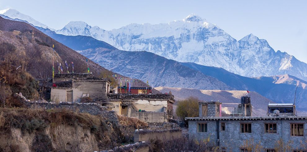
This lower country is warm, green and densely worked - rice, millet and cardamom terraces, banana and citrus, buffalo in the fields - and it is settled Limbu and Rai country rather than the Tibetan-influenced villages higher up. The Limbu are one of the indigenous peoples of eastern Nepal, with their own language and script.
The descent is long and, in the afternoon heat, more tiring than the numbers suggest. The trail eventually reaches the Tamor and follows it upstream.
Mitlung at 921 m is a small riverside settlement with simple lodges. It is the lowest point of the entire trek, and from here the route climbs, with interruptions, for the next ten days.
Five to six hours with around 900 m of descent. All meals provided. Overnight in Mitlung.
A day of following the Tamor upstream through the deep valley, with the trail undulating considerably rather than climbing steadily.
The path crosses several side streams on suspension bridges and passes through Sinwa and Tawa, small farming settlements where cardamom is the dominant cash crop - you will see it drying on racks and smell it in the air through much of this section.
The valley is steep-sided and thickly forested, with waterfalls dropping in from both sides. Landslide scars are common, and short sections of the trail are periodically rebuilt.
Chirwa at 1,270 m is a pleasant village strung along the trail with a few lodges and shops, the last place of any size for some days.
Five to six hours with around 350 m of net ascent and a good deal of up and down. All meals provided. Overnight in Chirwa.
The trail continues north along the Tamor, crossing to the eastern bank and passing through Tapethok, where the Kanchenjunga Conservation Area permit is checked at the entry post.
Beyond the checkpost the valley narrows and the character shifts - the villages become smaller and further apart, and the first Tibetan-influenced features appear: prayer flags, small chortens and mani stones beside the path.
The route passes Lelep and crosses the Ghunsa Khola where it joins the Tamor, then climbs to Sekathum at the confluence of the Ghunsa and Simbuwa valleys. The trail to the southern base camp branches here; you take the northern route up the Ghunsa.
Sekathum at 1,660 m is a handful of houses and lodges in a tight valley, with the first proper mountain views appearing at the head of the valley ahead.
Five to six hours with around 400 m of net ascent. All meals provided. Overnight in Sekathum.
A hard day, and one of the more demanding of the trek despite the modest distance. The trail turns north-east into the Ghunsa valley, which is narrow, steep and heavily forested.
The route crosses the river repeatedly on suspension bridges and climbs a series of very steep sections cut into the valley sides, some with fixed cables or wooden ladders. The gradient is relentless and the ground rough underfoot.
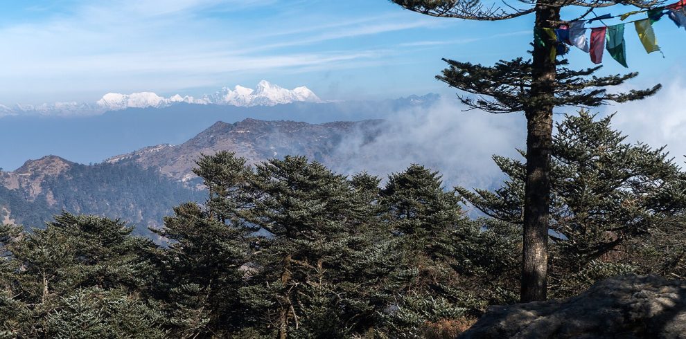
The forest through here is superb - oak, rhododendron and bamboo, thick with moss and epiphytes - and the valley is quiet enough that wildlife is regularly seen. Red panda are present, though rarely spotted, and langur monkeys are common.
Amjilosa at 2,308 m is a very small settlement on a shelf high above the river, with only a few basic lodges.
Six to seven hours with around 650 m of net ascent and considerable additional climbing and descending. All meals provided. Overnight in Amjilosa.
Continuing up the Ghunsa valley through some of the finest forest on the trek. The trail climbs steadily through rhododendron and bamboo, crossing waterfalls and passing through a landscape that in spring is spectacular with blossom.
The route passes Thyangyam and Phale - the latter a Tibetan refugee settlement established after 1959, with a small gompa and a carpet-weaving workshop where handicrafts are sold. It is worth stopping in.
As you gain height the bamboo drops away and conifers take over, and the valley begins to open. The air is noticeably cooler and the villages more obviously Tibetan in construction, with flat roofs and stacked firewood.
Gyabla at 2,730 m, also called Kyapra, is a small village in a clearing with basic lodges and views up the valley towards the peaks.
Five to six hours with around 420 m of net ascent. All meals provided. Overnight in Gyabla.
A steady climbing day that brings you into the high country at last. The trail continues north through pine and fir forest along the Ghunsa Khola, with the valley gradually widening.
You pass through Phale, a larger Tibetan settlement of flat-roofed houses with a gompa, prayer wheels and small shops selling weavings and yak-wool goods. Many families here still move seasonally between Phale and Ghunsa.
Beyond Phale the trees thin and the valley opens into broad alpine country. Ghunsa at 3,595 m is the largest settlement of the upper valley and the administrative centre for the area: a proper village of stone houses, a gompa, a micro-hydro scheme and a conservation area office.
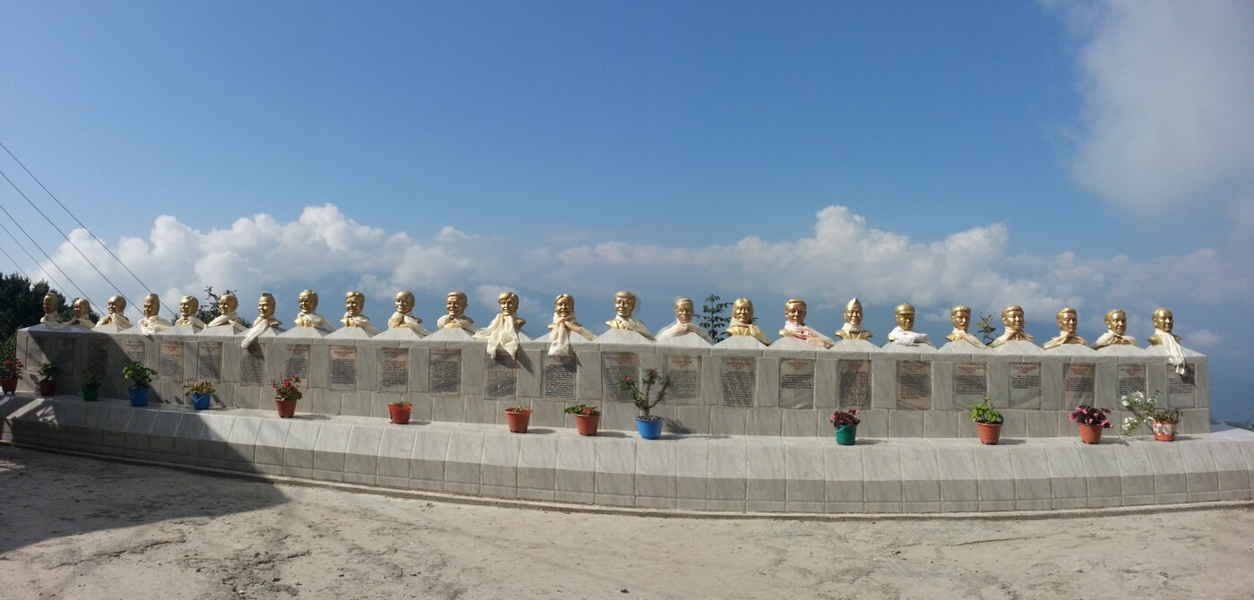
A memorial near the village commemorates the 2006 helicopter crash that killed twenty-four Nepali and international conservationists returning from a handover ceremony for the conservation area.
Five to six hours with around 865 m of ascent. All meals provided. Overnight in Ghunsa.
An acclimatisation day at 3,595 m, the first scheduled rest of the trek and a necessary one before the rapid altitude gain that follows.
The recommended walk climbs the ridge behind the village towards the Yamatari valley or up towards the viewpoint above Ghunsa, gaining three or four hundred metres and giving views of Jannu - Kumbhakarna - the extraordinary 7,710 m peak that dominates this section of the range.
Ghunsa itself repays a wander: the gompa, the water-driven prayer wheels, and the conservation area office which has displays on snow leopard and red panda monitoring in the valley.
This is also the last village of any size, and the last place with anything approaching reliable supplies. Your guide will check kit and food arrangements for the higher stages today.
Three to four hours with 300 to 400 m gained and lost. All meals provided. Overnight in Ghunsa.
The trail climbs north out of Ghunsa through the last of the pine and juniper, and within an hour or two the trees are behind you for good.
The route follows the Ghunsa Khola through open alpine country, crossing a landslide-prone section where the path has been rebuilt repeatedly - your guide will judge the timing of the crossing, which is best done early in the day.
The valley turns and Jannu comes into full view, a vast rock and ice pyramid that is one of the most striking mountains in Nepal from any angle. It dominates the entire afternoon's walking.
Kambachen at 4,145 m is a small seasonal settlement of stone huts and basic lodges beneath the Jannu glacier, occupied mainly in the trekking seasons. Facilities are minimal and nights are cold.
Five to six hours with around 550 m of ascent. All meals provided. Overnight in Kambachen.
A second acclimatisation day, at 4,145 m. Skipping it is tempting when the base camp is only two days away, but the ascent profile from here is steep and this day protects the rest of the trek.
The usual walk climbs towards the Jannu glacier viewpoint or up the ridge behind the settlement, gaining four to five hundred metres and returning. The close view of Jannu's north face from the moraine is remarkable, and the glacier is audibly active.
Blue sheep are frequently seen on the slopes around Kambachen, and this is prime snow leopard territory - sightings are extremely rare, but tracks are not uncommon in fresh snow, and your guide will point them out.
The afternoon is free to rest. Drink steadily and eat properly; the food here is simple and the choice narrow, but the calories matter.
Three to four hours with 400 to 500 m gained and lost. All meals provided. Overnight in Kambachen.
A high, exposed day into genuinely wild country. The trail climbs north from Kambachen across open moraine and boulder fields, following the north bank of the Ghunsa Khola.
You pass Ramtang and the snout of the Kanchenjunga glacier, where the route joins the lateral moraine and the landscape becomes entirely rock and ice. There is no vegetation of any kind through this section and no habitation between the two settlements.
The walking is not steep but it is rough and slow, over unstable moraine with the glacier below and a wall of peaks - Wedge Peak, Mera Peak and Nepal Peak - rising to the east.
Lhonak at 4,780 m sits on a flat sandy plain beside the glacier, a handful of stone huts in an enormous open bowl. It is a bleak, magnificent place, and the night is cold.
Five to six hours with around 640 m of ascent. All meals provided. Overnight in Lhonak.
The day you reach the mountain. An early start follows the lateral moraine of the Kanchenjunga glacier north-east, a long and rough but not steep walk of four to five hours.
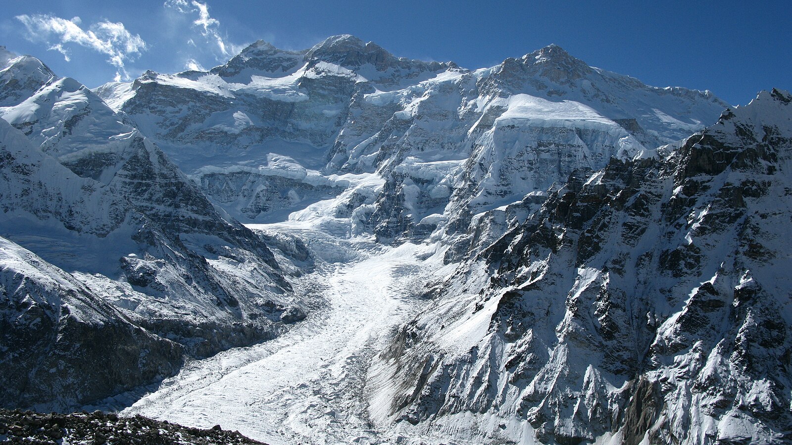
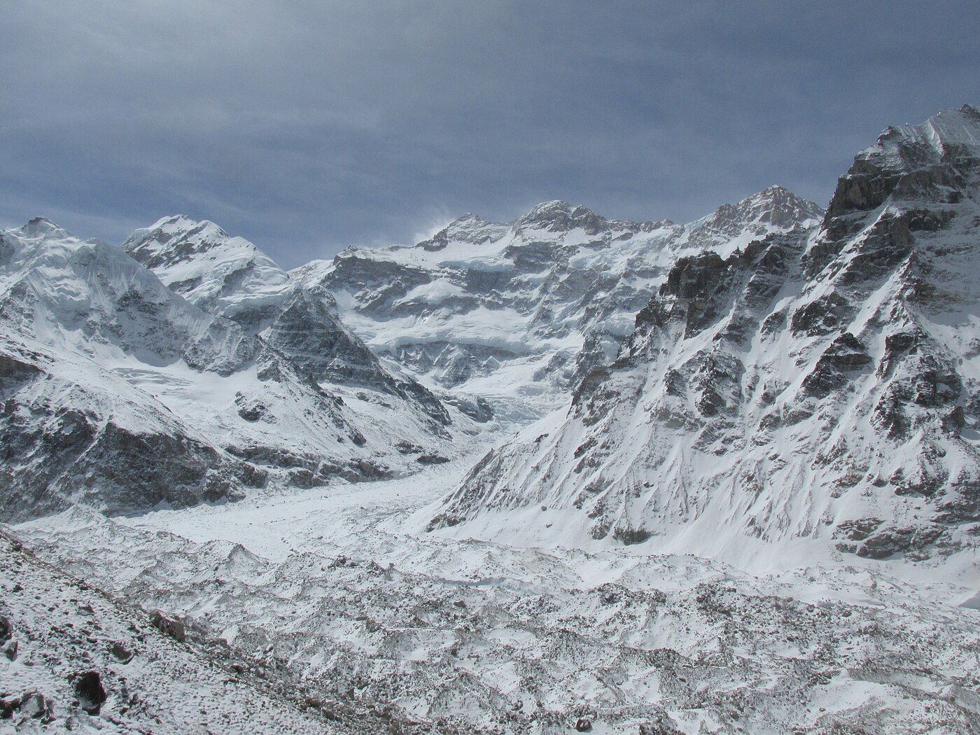
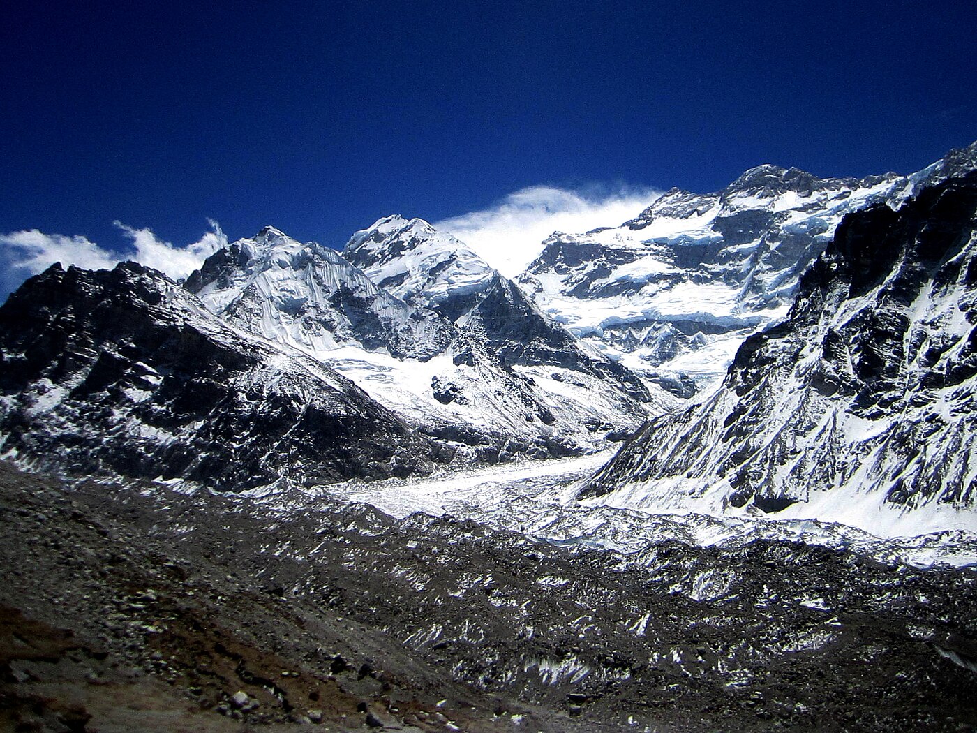
The route climbs gradually with the glacier below and the peaks closing in on both sides. Twin Peaks, Nepal Peak, Tent Peak and Wedge Peak line the eastern wall, and the scale of the country here is difficult to convey - there is nothing and nobody for miles in any direction.
Pangpema at 5,143 m is the northern base camp: a bare, flat area of moraine facing the immense north face of Kanchenjunga, an eight-thousander presented in full from base to summit across the glacier. It is a view very few people ever see.
Those with the energy can climb the moraine ridge above camp for another hundred metres or so, which opens the panorama further. After time at base camp you return along the moraine to Lhonak.
Seven to eight hours with around 360 m of ascent and the same in descent. All meals provided. Overnight in Lhonak.
The return journey begins. The trail retraces the moraine south from Lhonak past Ramtang and the glacier snout, then drops through the open valley to Kambachen.
Walking south the perspective is entirely different, with Jannu ahead for much of the way rather than behind, and the light falling on faces that were in shadow on the way up.
From Kambachen the route continues down the valley, recrossing the landslide section and dropping steadily back towards the treeline. Juniper and then pine reappear, and the air thickens noticeably.
Arriving in Ghunsa at 3,595 m means sleeping nearly 1,200 m lower than last night. It is a long day but almost entirely downhill, and after four nights above 4,100 m the comfort is considerable.
Six to seven hours with around 1,185 m of descent. All meals provided. Overnight in Ghunsa.
A long descending day back down the Ghunsa valley, retracing the outward route through Phale and Gyabla and on down through the forest.
The vegetation thickens rapidly as height is lost, from conifer back into rhododendron and then bamboo, and the temperature climbs through the afternoon. The valley is loud with birdsong again after the silence of the high moraine.
The steep sections above Amjilosa that were hard work on the way up are hard work in a different way going down - loose, rough and unrelenting on the knees. Trekking poles make a real difference here.
Amjilosa at 2,308 m is reached in the late afternoon. It is a long day, and most groups arrive tired.
Six to seven hours with around 1,290 m of descent. All meals provided. Overnight in Amjilosa.
Continuing down the Ghunsa valley, descending the steep cut sections and ladders to the river and following it back to the confluence at Sekathum.
From there the route rejoins the Tamor and turns south, following the main valley downstream through Lelep and Tapethok, where you sign out at the conservation area post.
The walking is easier than the previous two days, undulating along the valley rather than dropping steeply, and the country is settled and cultivated again - cardamom terraces, farmhouses and grazing land.
Chirwa at 1,270 m has the best facilities you will have seen in a fortnight, which after Lhonak feels almost luxurious.
Six to seven hours with around 1,040 m of descent. All meals provided. Overnight in Chirwa.
A relatively short and gentle day following the Tamor downstream through Tawa and Sinwa, crossing side streams on suspension bridges.
The valley is warm and humid at this altitude and the walking is pleasant rather than demanding, through cardamom plantations and terraced fields with the river alongside for most of the way.
This is a good day for conversation with your guide and porters, and for taking in the lower valley properly - most people pass through here on the way up too focused on the days ahead to notice much of it.
Mitlung at 921 m is the lowest point of the trek, reached in the early afternoon.
Four to five hours with around 350 m of descent. All meals provided. Overnight in Mitlung.
The final walking day, and a demanding one - the long climb back up to the Taplejung ridge, reversing the descent that began the trek.
The trail leaves the Tamor and climbs steadily through terraced farmland and Limbu villages, gaining some 900 m over four to five hours. In the middle of the day the heat at this altitude makes it harder than the numbers suggest, so an early start is worthwhile.
As you climb, the views open back over the Tamor valley and, on a clear day, north to the peaks you have spent two weeks among.
Arriving in Taplejung at around 1,820 m the trek is over. There are hot showers, shops and a proper meal, and the evening is spent with the guides and porters - the customary point for tips.
Five to six hours with around 900 m of ascent. All meals provided. Overnight in a lodge in Taplejung.
The long drive back down to the Terai, retracing the route through Phidim and the Ilam tea gardens to Bhadrapur.
The descent through four climate zones in a single day is as striking in this direction as it was on the way up - from cool hill town through the tea terraces and into the humid, flat, tropical lowland near the Indian border.
There is usually time to stop in Ilam, and a walk through the tea gardens or a visit to a processing factory is worth doing if the schedule allows. Ilam tea is excellent and considerably cheaper here than in Kathmandu.
Total travel time is eight to ten hours depending on road conditions, with a stop for lunch.
Breakfast and lunch provided. Overnight in a hotel in Bhadrapur.
A morning flight from Bhadrapur to Kathmandu, around forty-five minutes, with good views of the eastern Himalaya along the northern horizon on a clear day - including, if you are lucky, a last sight of Kanchenjunga itself.
You are met on arrival and transferred to your hotel. The rest of the day is free, and after three weeks in a remote region most people head straight for a shower, a good meal and a wander through Thamel.
This day is also the buffer in the itinerary. The Bhadrapur flight can be delayed by weather or by the road journey running long, and having a full day in Kathmandu before any international departure protects against that.
In the evening there is a farewell dinner at a Nepali restaurant in the city, usually with traditional music and dance.
Breakfast and dinner provided. Overnight in Kathmandu.
The trip ends today. Depending on your flight time there may be a free morning for last-minute shopping or a final look around the city.
If your flight is late, day-use of a hotel room can be arranged so you have somewhere to shower and repack rather than waiting at the airport.
You are transferred to Tribhuvan International Airport approximately three hours before departure, as international check-in in Kathmandu can be slow.
If you would like to extend your stay - Chitwan, Pokhara, Lumbini or a few days in the Kathmandu Valley - we are glad to arrange it, and it is best raised before the trek rather than at the end of it.
Breakfast provided.
Cost Includes/Excludes
Cost Includes
- Airport transfers and hotel nights in Kathmandu with breakfast
- Kathmandu to Bhadrapur return flights
- All road transfers between Bhadrapur and Taplejung
- Teahouse and lodge accommodation throughout the trek
- All meals during the trek: breakfast, lunch and dinner
- Kanchenjunga Restricted Area Permit and KCAP permit
- Government-licensed English-speaking trekking guide and assistant
- One porter shared between two trekkers (up to 20kg)
- Guide and porter wages, insurance, meals and accommodation
- Emergency oxygen, first aid kit and pulse oximeter
- All applicable government taxes
Cost Excludes
- International flights and Nepal visa fees
- Lunch and dinner in Kathmandu
- Travel and medical insurance with cover to 5,200m including helicopter evacuation
- Personal trekking equipment and clothing
- Drinks, hot showers, Wi-Fi and charging on the trail
- Extra nights caused by weather or flight delays
- Tips for guide and porter
FAQs
Very. Beyond Ghunsa there is limited mobile signal, no reliable charging and no road access. Evacuation would be by helicopter and weather-dependent, so comprehensive insurance is essential rather than optional.
Basic. Simple rooms, shared facilities and limited menus compared with Everest or Annapurna. Some upper-valley lodges close outside the main seasons, in which case we carry camping support.
Yes. Kanchenjunga is a restricted area requiring a minimum of two trekkers and a licensed guide, with permits issued through a registered agency.
Yes. Adding the southern base camp at Oktang via the Sele La passes extends the trek to around 24 to 26 days. Contact us for a full circuit itinerary.