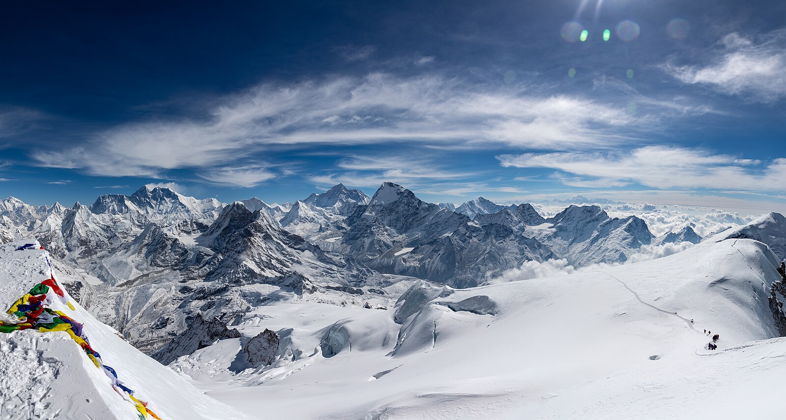
Mera Peak is the highest of Nepal's designated trekking peaks at 6,476m, and the summit panorama takes in five 8,000m mountains: Everest, Lhotse, Makalu, Cho Oyu and Kanchenjunga.
Technically it is gentler than Island Peak, mostly a long snow slope with a short fixed section near the top. What makes it demanding is the altitude and the length of summit day.
Trip Highlights
- Nepal's highest trekking peak at 6,476m
- Five 8,000m peaks visible from the summit
- The quiet and beautiful Hinku valley, far from the main Khumbu trails
- Crossing the Zatrwa La (4,610m) on the approach
- Technically gentler than Island Peak, with a training day included
- NMA-certified climbing guide and full group equipment
Overview
Mera Peak is the highest of Nepal's designated trekking peaks at 6,476m, and the summit panorama takes in five 8,000m mountains: Everest, Lhotse, Makalu, Cho Oyu and Kanchenjunga.
Technically it is gentler than Island Peak, mostly a long snow slope with a short fixed section near the top. What makes it demanding is the altitude and the length of summit day.
Trip Highlights
- Nepal's highest trekking peak at 6,476m
- Five 8,000m peaks visible from the summit
- The quiet and beautiful Hinku valley, far from the main Khumbu trails
- Crossing the Zatrwa La (4,610m) on the approach
- Technically gentler than Island Peak, with a training day included
- NMA-certified climbing guide and full group equipment
Trip Highlights
- Nepal's highest trekking peak at 6,476m
- Five 8,000m peaks visible from the summit
- The quiet and beautiful Hinku valley, far from the main Khumbu trails
- Crossing the Zatrwa La (4,610m) on the approach
- Technically gentler than Island Peak, with a training day included
- NMA-certified climbing guide and full group equipment
Itinerary of Mera Peak Climbing – 17 Days
You are met at Tribhuvan International Airport and transferred to your hotel in Kathmandu, with the remainder of the day free.
At 6,476 m Mera Peak is the highest of Nepal's designated trekking peaks. Technically it is far more straightforward than Island Peak - the summit is reached by a long glacier walk on a rope team rather than a fixed-rope headwall - but the altitude is considerably greater, and it is that, not the climbing, which decides most attempts.
The afternoon briefing covers the route through the Hinku valley, the acclimatisation plan and the summit day, along with a full gear check. Climbing permits through the Nepal Mountaineering Association and the Makalu Barun National Park permits are arranged now, so bring your passport, photographs and insurance.
Insurance must cover mountaineering to 6,500 m including helicopter evacuation. We will check the wording rather than take it on trust.
Crampons, harness, ice axe and jumar can be hired in Kathmandu or at Khare; boots should be your own and already worn in. Overnight in a three-star hotel in Kathmandu.
An early transfer for the flight to Lukla, thirty-five minutes between the ridges to the sloping runway at 2,860 m. In peak season the flight leaves from Ramechhap instead, requiring a road transfer in the small hours.
Unlike the Everest trails, the Mera route turns immediately away from the main Khumbu valley. From Lukla you head south and then east, climbing out of the settled country almost at once.
The trail ascends through rhododendron and pine forest towards the Kalo Himal ridge, and within an hour or two you have left the teahouse traffic entirely behind. This is a wild and lightly travelled valley, and the change of atmosphere is immediate.
Chutanga at 3,050 m is a small clearing with basic lodges and camping ground beneath the Zatrwa La. Around three to four hours of walking with roughly 200 m of net ascent.
Lunch and dinner provided. Overnight at Chutanga.
An acclimatisation day at Chutanga, placed here deliberately because tomorrow crosses a 4,610 m pass - a serious altitude gain this early in a trek.
The day is spent walking up towards the pass and back, gaining three or four hundred metres on the approach slopes before returning to sleep low. It is the standard climb-high-sleep-low pattern, and on this route it matters a great deal.
The walk gives good views back over the Dudh Koshi valley and out towards Kongde Ri and the peaks above Lukla, and lets your guide see how the group is moving before committing to the pass.
The rest of the day is free to rest. Drink steadily, eat well, and raise any headache early - the Hinku valley beyond the pass has very limited facilities and evacuation is harder from there than from the main Khumbu.
Three to four hours with 300 to 400 m gained and lost. All meals provided. Overnight at Chutanga.
A long and demanding day crossing the Kalo Himal ridge into the Hinku valley. You start early for the sustained climb to the Zatrwa La at 4,610 m, some four hours of steady ascent on rock and, often, snow.
The pass is marked by cairns and prayer flags, and the view from the top is exceptional: back over the Lukla valley and Kongde Ri, and forward into the Hinku with Mera Peak, Kusum Kangguru and Karyolung ranged ahead.
The descent on the eastern side is steep and rough underfoot, dropping through boulder fields and alpine scrub, before easing onto the hillside above the Hinku valley.
Thuli Kharka at 4,300 m is a scattering of simple lodges on an open shoulder with a fine outlook across the valley. It is a high place to sleep after a hard day, and most people feel the altitude tonight.
Six to seven hours with around 1,560 m of ascent and 300 m of descent. All meals provided. Overnight at Thuli Kharka.
A descending day into the heart of the Hinku valley, and a considerable relief after yesterday.
The trail contours around the hillside before dropping steeply through dense rhododendron, birch and pine forest towards the valley floor. The change in vegetation as you lose 700 m is rapid, and the forest here is thick, mossy and largely untouched.
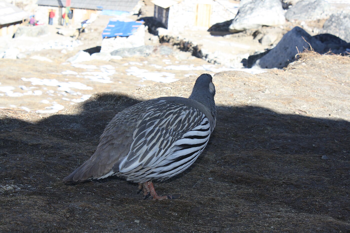
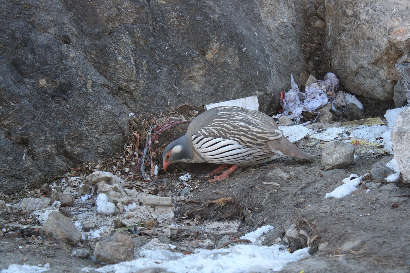
This is prime habitat for Himalayan tahr and musk deer, and the birdlife is excellent - danphe, blood pheasant and various rosefinches are commonly seen. The valley sees so few people that wildlife is comparatively unwary.
Kothe at 3,600 m sits on the west bank of the Hinku Khola, a small collection of lodges among the trees with Mera Peak visible up the valley to the north.
Five to six hours with around 700 m of descent. Sleeping this much lower makes for a far better night. All meals provided. Overnight in Kothe.
The trail turns north and follows the Hinku Khola upstream, climbing steadily along the valley floor with the river alongside for most of the morning.
The forest thins and gives way to juniper and dwarf rhododendron as you gain height, and the valley opens into classic alpine country - moraine, boulder fields and summer grazing. Mera Peak grows steadily ahead.
A short detour partway up leads to Gompa Lungmuche, a small monastery and a boulder shrine beneath a rock overhang where climbers traditionally make an offering before going higher. It is a quiet and rather moving place.
Thangnak at 4,350 m is a seasonal herders' settlement of stone huts and basic lodges beneath the Kyashar and Charpate Himal, with the Sabai Tsho glacial lake a short walk above.
Four to five hours with around 750 m of ascent. All meals provided. Overnight in Thangnak.
A scheduled acclimatisation day, and the second of three on this route - the reason the itinerary is seventeen days rather than twelve.
The usual walk climbs to Sabai Tsho, a turquoise glacial lake at around 4,900 m held behind a moraine dam beneath the Sabai glacier. It is a striking spot, and the lake has a history: a partial dam collapse in 1998 sent a flood down the Hinku valley, and the debris is still visible along the riverbed below.
The climb takes two to three hours there and back and gains around 550 m, which is exactly the sort of load the body needs at this stage.
Back at Thangnak the afternoon is free. This is a good moment to go through your climbing gear with the guide again and to sort what you will carry to high camp against what stays behind.
Three to four hours with 550 m gained and lost. All meals provided. Overnight in Thangnak.
A short but high day, moving up beside the Dig Glacier towards the foot of the mountain.
The trail climbs the lateral moraine, rough and rocky underfoot, passing Dig Kharka where the valley opens out and the north face of Mera comes fully into view. From here the summit route is visible in its entirety - the glacier, the long snow slope and the summit dome.
The last stretch to Khare is a steep pull up moraine, hard work at this altitude, arriving at 5,045 m. Khare is the last settlement before the mountain: a cluster of lodges on a rocky shelf, with equipment for hire and a small stock of supplies.
The Mera glacier and Mera La are directly above, and Kusum Kangguru, Kyashar and Charpate Himal ring the valley.
Three to four hours with around 700 m of ascent. All meals provided. Overnight in Khare.
The final preparation day, spent both acclimatising and training, and much of your summit chance rests on it.
In the morning your climbing guide takes the group onto the lower Mera glacier for practical instruction: fitting and walking in crampons, ice axe use and self-arrest, roping up and moving as a team, and rope management on glacier terrain. Mera does not involve fixed-rope climbing, but confident crampon technique and rope discipline are essential.
The session doubles as an acclimatisation climb, typically reaching around 5,300 to 5,400 m on the glacier before returning to Khare.
The afternoon is spent resting and packing. Only what is needed goes to high camp; everything else stays at Khare. Your guide will brief the summit plan and confirm the timings.
Four to five hours with around 300 m gained and lost. All meals provided. Overnight in Khare.
A short day in distance and a substantial one in altitude, moving up to high camp.
The morning begins with a steep rocky climb out of Khare to the edge of the Mera glacier, where crampons go on and the group ropes up. From there the route crosses the glacier on a steady ascent to the Mera La at 5,415 m, a broad snow col between the Hinku and Hongu valleys.
The crossing is not difficult but the altitude is now fully apparent, and progress is slow and deliberate. From the col the route continues up the glacier to high camp.
Mera High Camp at 5,800 m sits on a rock outcrop above the glacier, and the position is spectacular: five eight-thousanders - Everest, Lhotse, Makalu, Cho Oyu and Kanchenjunga - are visible from camp on a clear evening, along with Nuptse, Chamlang and Baruntse. Accommodation is tented.
Four to five hours with around 750 m of ascent. Eat early and sleep as best you can. All meals provided. Overnight at High Camp.
Summit day. You leave around two in the morning, roped and in crampons, for the long glacier ascent by head torch. The cold before dawn at this altitude is severe, and mittens, a good down jacket and a warm flask matter enormously.
The route is a sustained snow slope rather than a technical climb - no steep ice, no fixed ropes - but it is relentless, and at these altitudes each step demands deliberate breathing. Sunrise usually catches the group partway up, with the light coming across Makalu and Kanchenjunga.
A final short steep section, sometimes with a fixed line depending on conditions, leads onto the summit dome at 6,476 m. The panorama is among the very best in the Himalaya: Everest, Lhotse, Makalu, Cho Oyu and Kanchenjunga - five of the world's six highest mountains - all visible at once, with Nuptse, Chamlang, Baruntse and Ama Dablam around them.
The descent is long. You return to high camp, pack, and continue down the glacier and off the moraine to Khare, dropping over 1,400 m from the summit.
Eight to ten hours in total. All meals provided. Overnight in Khare.
A contingency day, reserved and used only if required.
On Mera the usual reason is weather: high wind on the summit dome or heavy fresh snow on the glacier can make an attempt unwise, and having a spare day turns a postponement into a second chance rather than the end of the trip.
It equally covers a group that needs longer to acclimatise, illness, or a summit push that had to turn back short. Given the effort and cost involved in reaching Khare, a single fixed summit date would be poor planning.
If the summit was reached yesterday, the day is spent resting at Khare or beginning the descent early towards Kothe, which most people prefer - sleeping lower is welcome after two nights above 5,000 m.
All meals provided. Overnight in Khare or Kothe.
The return down the Hinku valley, retracing the route with the whole descent ahead of you and with legs that suddenly work properly again as the air thickens.
The trail drops off the moraine below Khare and follows the valley south through Dig Kharka and Thangnak, then continues down beside the Hinku Khola.
Juniper gives way to rhododendron and then to full forest, and the temperature climbs noticeably through the afternoon. After the bare rock and snow of the last five days the greenery is a genuine pleasure, and appetite tends to return with a vengeance.
Kothe at 3,600 m is nearly 1,450 m below Khare, and the difference in how well everyone sleeps is dramatic.
Five to six hours with around 1,450 m of descent. All meals provided. Overnight in Kothe.
The long climb back out of the Hinku valley towards the Kalo Himal ridge, reversing the descent you made on the way in.
The trail climbs steadily through the forest, gaining some 700 m, with the vegetation thinning as you rise. There are good views back up the valley to Mera, and seeing the mountain you have just climbed from a distance is a fitting way to say goodbye to it.
The last section contours around the hillside on open ground to Thuli Kharka at 4,300 m, beneath the Zatrwa La.
It is a hard-working day and the climb feels longer than it did in descent, but with the summit behind you and no further altitude to worry about, the mood on this stage is usually excellent.
Five to six hours with around 700 m of ascent. All meals provided. Overnight at Thuli Kharka.
The final trekking day, recrossing the Zatrwa La at 4,610 m and dropping back into the Lukla valley.
The climb to the pass takes around two hours from Thuli Kharka, considerably shorter than the ascent from the western side. From the top there is a last view back over the Hinku valley and the peaks around Mera before you turn away from them.
The descent is long and steep - some 1,800 m down to Lukla over four to five hours, through boulder fields and then rhododendron forest, rejoining the settled country around Chutanga before the last stretch into town. It is hard on the knees and trekking poles are worth using.
Arriving in Lukla you are back among teahouse traffic, bakeries and hot showers for the first time in two weeks.
The evening is spent with the guides, climbing guide and porters over a final dinner - the customary point for tips. Six to seven hours. All meals provided. Overnight in Lukla.
An early transfer to Lukla airport for the thirty-five minute flight to Kathmandu, or to Ramechhap with an onward road transfer depending on the season. Flights leave at dawn before the valley wind builds.
Delays are routine at Lukla and should be planned for rather than hoped against, which is why the itinerary keeps a day in Kathmandu at the end. If weather closes the airstrip for longer, a helicopter can usually be arranged at additional cost.
You are met on arrival and transferred to your hotel. The rest of the day is free, and after seventeen days a long hot shower and a proper meal tend to take precedence over sightseeing.
In the evening there is a farewell dinner at a Nepali restaurant with music and dance, and summit certificates issued through the Nepal Mountaineering Association are usually presented.
Breakfast and dinner provided. Overnight in Kathmandu.
The trip ends today. Depending on your flight time the morning may be free for last-minute shopping in Thamel.
If you are flying late in the day, day-use of a hotel room can be arranged so you have somewhere to shower and repack rather than waiting at the airport.
You are transferred to Tribhuvan International Airport around three hours before departure, since international check-in in Kathmandu can be slow.
If you would like to extend your stay - Chitwan, Pokhara or Lumbini all work well as add-ons - we are glad to arrange it, ideally discussed before the trek rather than after.
Breakfast provided.
Cost Includes/Excludes
Cost Includes
- Airport transfers and hotel nights in Kathmandu with breakfast
- Kathmandu to Lukla return flights including airport taxes
- Teahouse accommodation on trek and tented camp at Mera High Camp
- All meals during the trek and climb
- NMA-certified climbing guide plus trekking guide
- Mera Peak climbing permit and Makalu Barun National Park permit
- Local municipality permit
- Group climbing equipment: rope, ice screws, snow bar and fixed lines
- One porter shared between two climbers (up to 20kg)
- Emergency oxygen, first aid kit and pulse oximeter
- All applicable government taxes
Cost Excludes
- International flights and Nepal visa fees
- Personal climbing equipment: boots, harness, crampons, ice axe, jumar
- Travel and medical insurance covering mountaineering above 6,500m including helicopter evacuation
- Lunch and dinner in Kathmandu
- Drinks, hot showers, Wi-Fi and charging on the trail
- Extra nights caused by weather or flight delays
- Summit bonus and tips for guide and porter
FAQs
Technically yes, as it is mostly a long snow slope rather than a steep headwall. But Mera is 287m higher and summit day is longer and colder, so many climbers find it the harder of the two overall.
Frequently below minus 20C with wind chill at the start. Proper mountaineering boots, a down suit or heavy down jacket, and quality gloves are essential. We can advise on hire options in Kathmandu.
It is the direct approach from Lukla into the Hinku valley. The crossing also serves as useful early acclimatisation, which is why an extra night at Chutanga is built in beforehand.
Sleeping tents, dining tent, mattresses, all cooking equipment and a full camp crew. You need to bring or hire a sleeping bag rated to minus 20C or lower.